£500
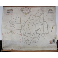
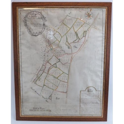
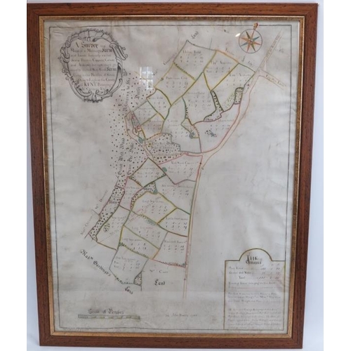
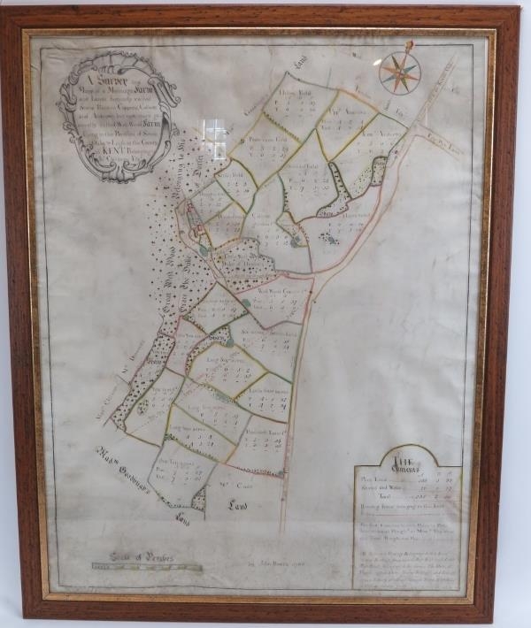
Of local interest: A hand drawn and colour highlighted map of West Wood farm and lands in Kent, 18th century. Drawn on vellum paper by John Bowra in 1766. The top left cartouche inscribed ‘A Survey and Map of a Messuage Farm and Lands, formerly called Stone Ridden Coppens, Collens and Andrews but now more generally called West Wood Farm lying in the Parishes of Seven Oaks & Leigh in the County of Kent. Belonging to Jn Children Esq.’ Glazed and framed. 87 cm x 66 cm.
Condition report: Some wear with age as illustrated.
Fees apply to the hammer price:
Free Registration
26.4% inc VAT*
Flat Fee Registration
22.80% inc VAT*