![5999 - Travel and Cartography - Morgan (William), Ogilby's and Morgan's Pocket-Book of the Roads [...], To ...](https://content.easyliveauction.com/auctions/images_lots/D25E94ED10D7736022C9C89B4DE884E8_bam01/1100045121_PREVIEW.JPG)
£600
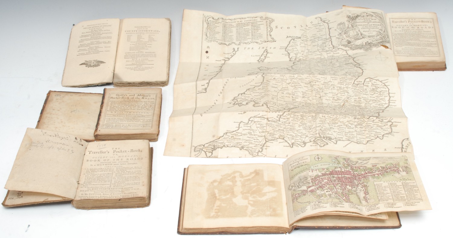
Travel and Cartography - Morgan (William), Ogilby's and Morgan's Pocket-Book of the Roads [...], To which is added, A List of the Principal Trading Towns [...], tenth edition, London: Printed for J. Brotherton [...], 1745, contemporary calf (disbound), square 16mo, (1); the fourth edition, London: Printed for J. Brotherton [...], [n.d., c. 1760], with fold-out national map as the frontispiece, contemporary calf, quite plain, red-speckled edges, square 16mo, (1); the nineteenth edition, edited by Salmon, London: Printed for J. Buckland [...], [n.d., 1778?], contemporary hessian covers, contemporary ink MS ownership inscription: John Brookbanks?, square 16mo, (1); an 18th century album of 40 English and Irish maps or street plans, contents leaf only: no bibliographic information hand-coloured and copperplate printed throughout, the urban aerial views including Kensington and other provincial cities or large towns, contemporary speckled calf, gilt-tooled and lettered spine, endpapers with contemporary French MS, oblong 8vo, (1); Cooke (G.A.), The Modern British Traveller: or, Tourist's Pocket Directory [...], Illustrated with Maps of the Counties, forming a Complete British Atlas, pp: two fold-out hand-coloured maps, [xix], [20]-167, [1] (contents), contemporary paper wrappers, 12mo, (1), [5]
Fees apply to the hammer price:
Free Registration
28.8% inc VAT*
Flat Fee Registration
25.20% inc VAT*