£480
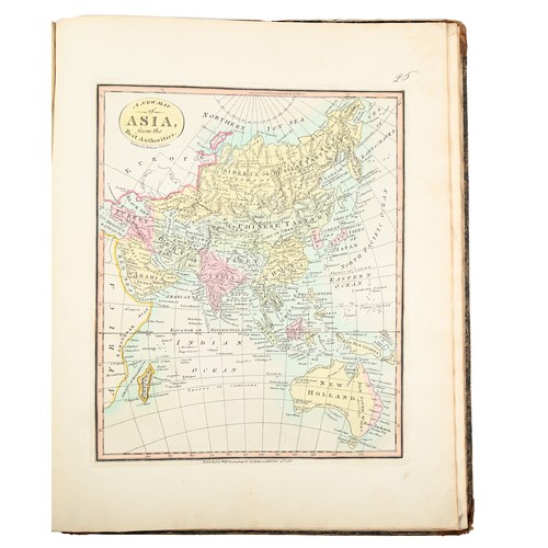
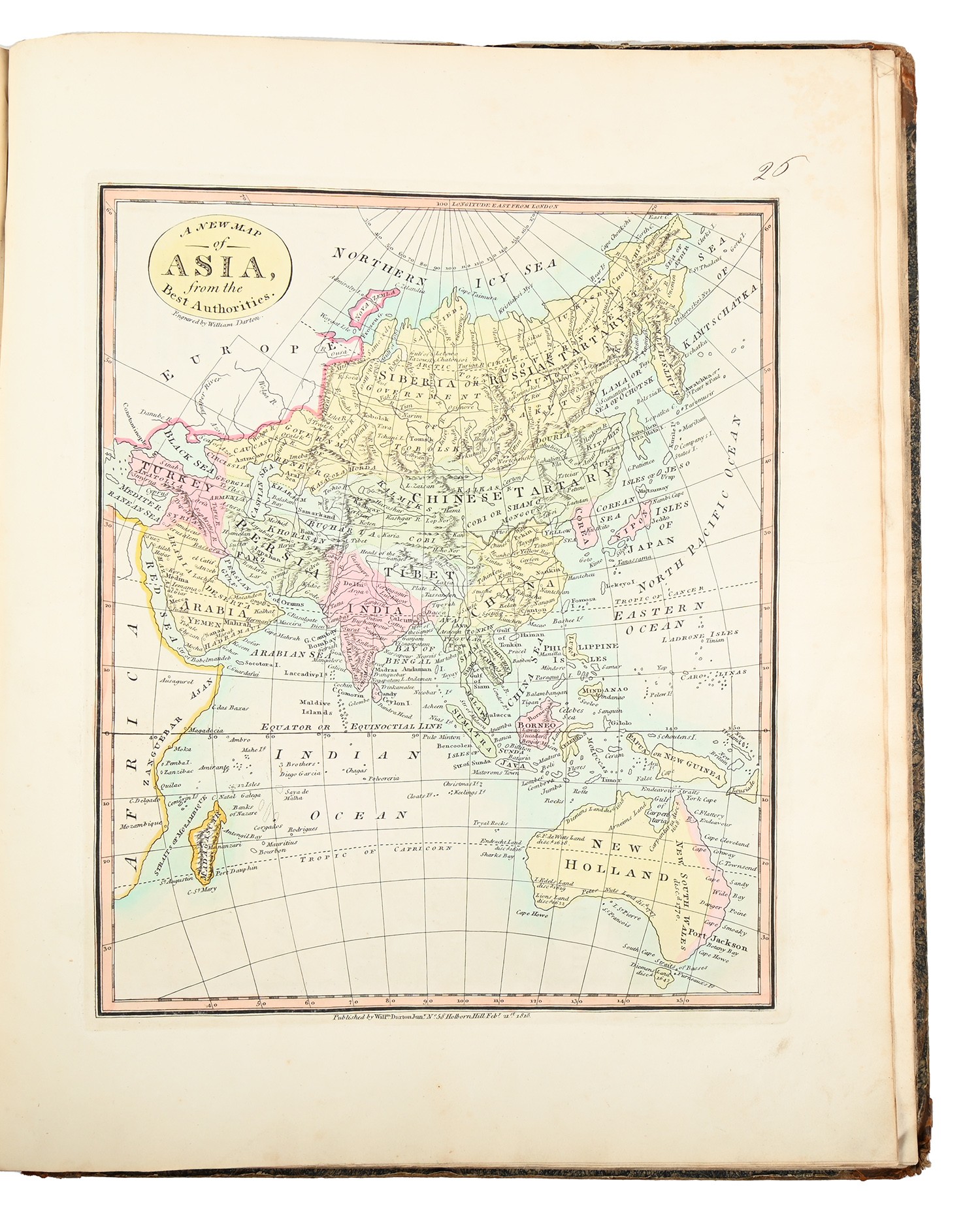
Darton (William), 38 Maps. The Union Atlas, Containing New and Improved Maps Of all the Empire, Kingdoms, and States in the Known World; Designed as Companion to the various Gazetteers and Books of Geography now in Use. The whole clearly Engraved by Artists of Eminence, and carefully Coloured; Including Maps of the Roman Empire and Ancient Greece, London: Printed by W. Darton, 1812, engraved allegorical title-page, letterpress contents leaf, complete with thirty-eight engraved and hand-coloured maps, each margin numbered in ink MS, some marginal grime and soiling, France with a small ink blemish South America defective with a burnt hole, the blemish following through and affecting Arabia, original marbled boards, corners bumped and chipped, upper-cover with chipped paper title label, spine perished, upper-cover loose, contents split with a little movement but holding, doodling inscriptions on pastedowns, crown folio (40.5 x 33cm).
Provenance: Frances Finchett, contemporary ink MS ownership inscription on title-page.
Fees apply to the hammer price:
Free Registration
27.6% inc VAT*
Flat Fee Registration
24.00% inc VAT*