


No Estimate
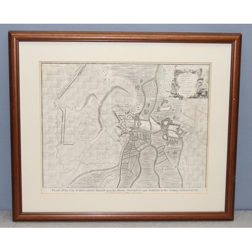
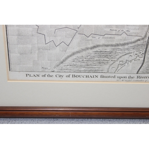
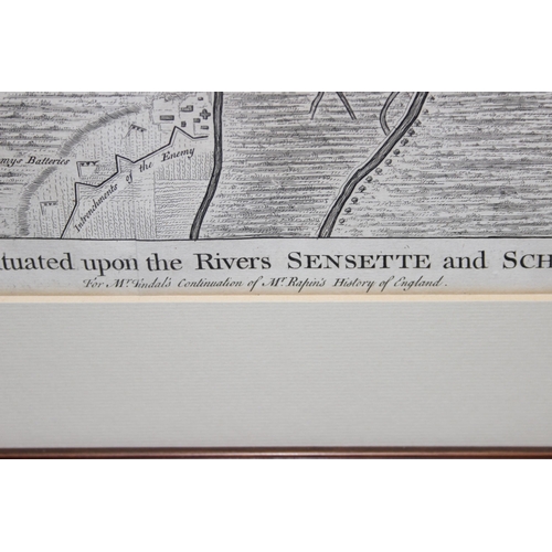
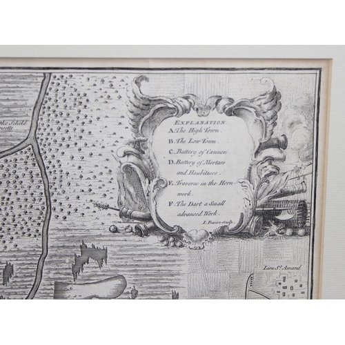
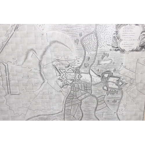
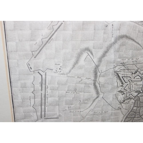
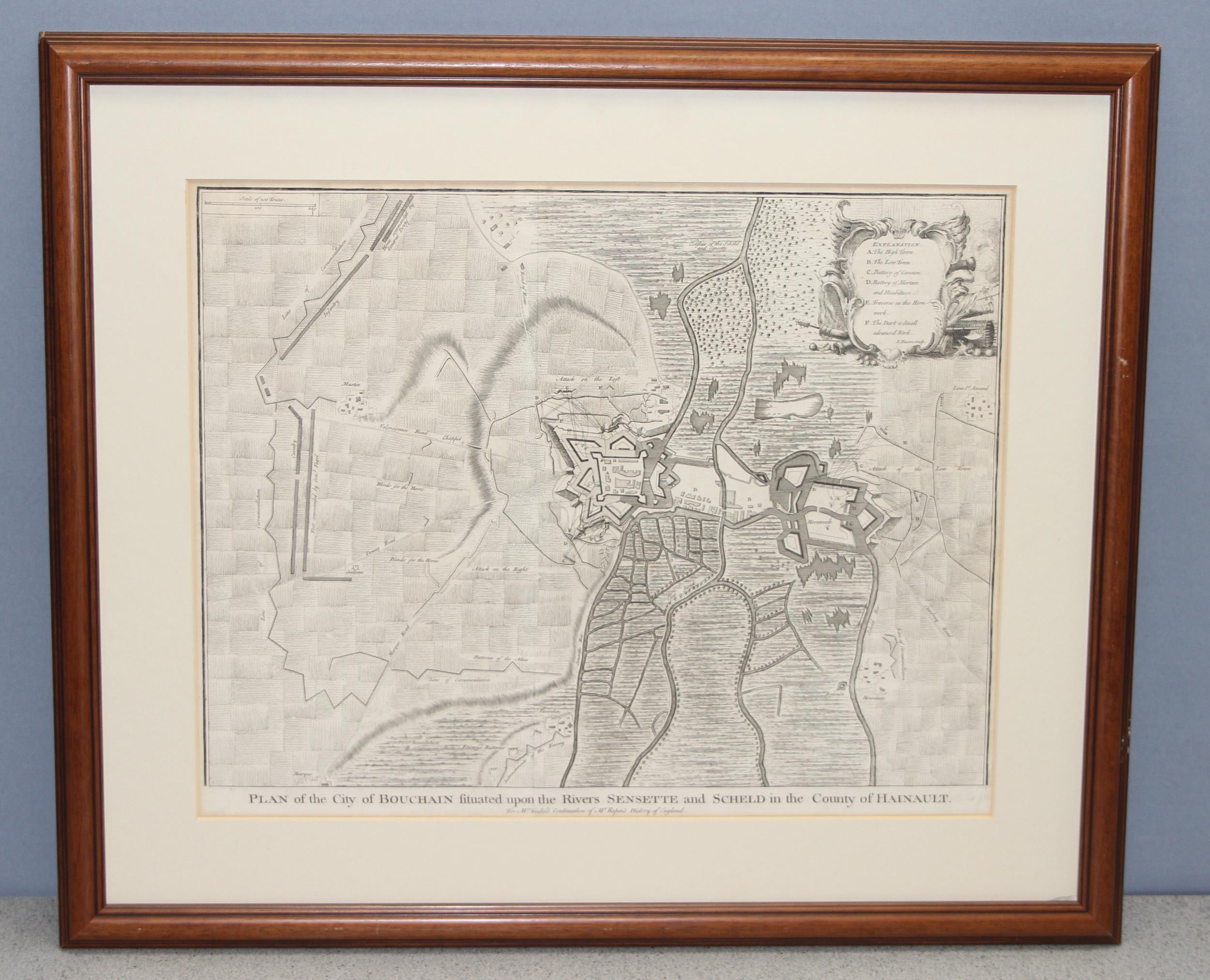
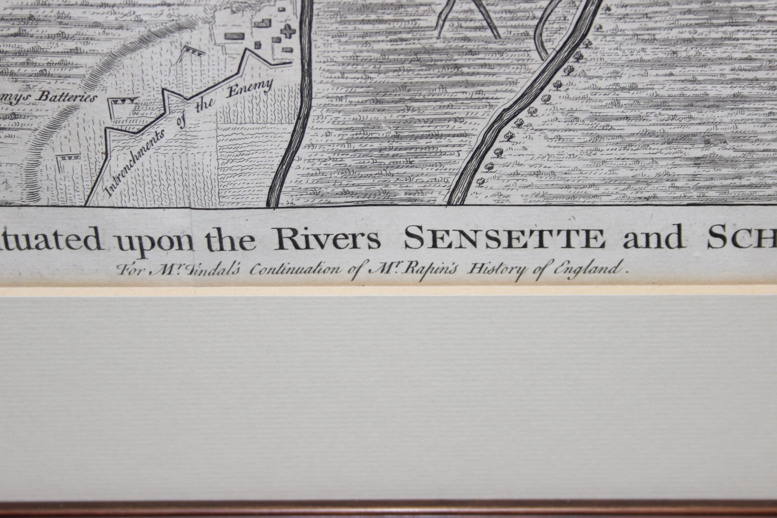
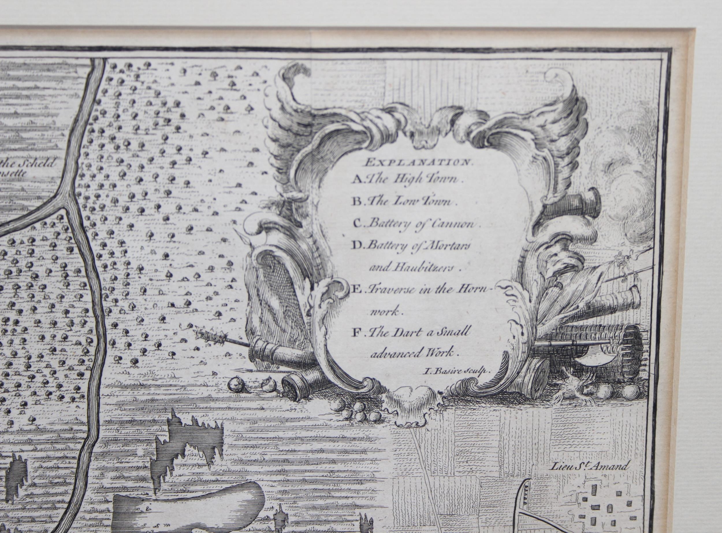
18th century map - Plan of the City of Bouchain situated upon the Rivers Sensette and Scheld in the County of Hainault". From Tindal's Continuation of Mr. Rapin's History of England engraved by James Basire c.1744. A detailed plan showing city fortifications and the vicinity with Allied siege works and dispositions, during the War of Succession in which Spain lost many possessions both in Europe and the New World, in later frame, approx 65cm x 55cm inc frame, no glass
Postage Group - X (No postage or packing)
Condition reports are available upon request, no item should be assumed to be in good condition unless a condition report states so.
All electrical and mechanical lots (to include but not limited to watches, clocks, cameras, Hi-Fi) are sold as non working without exception.
For full Terms & Conditions please see the Churchill Auctions website
Fees apply to the hammer price:
Free Registration
25.2% inc VAT*
Flat Fee Registration
21.60% inc VAT*