£110
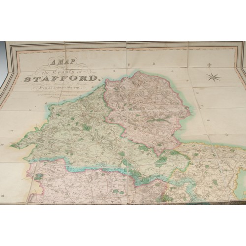
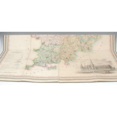
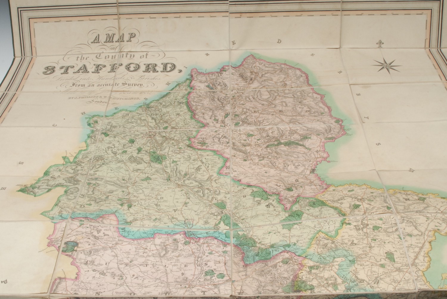
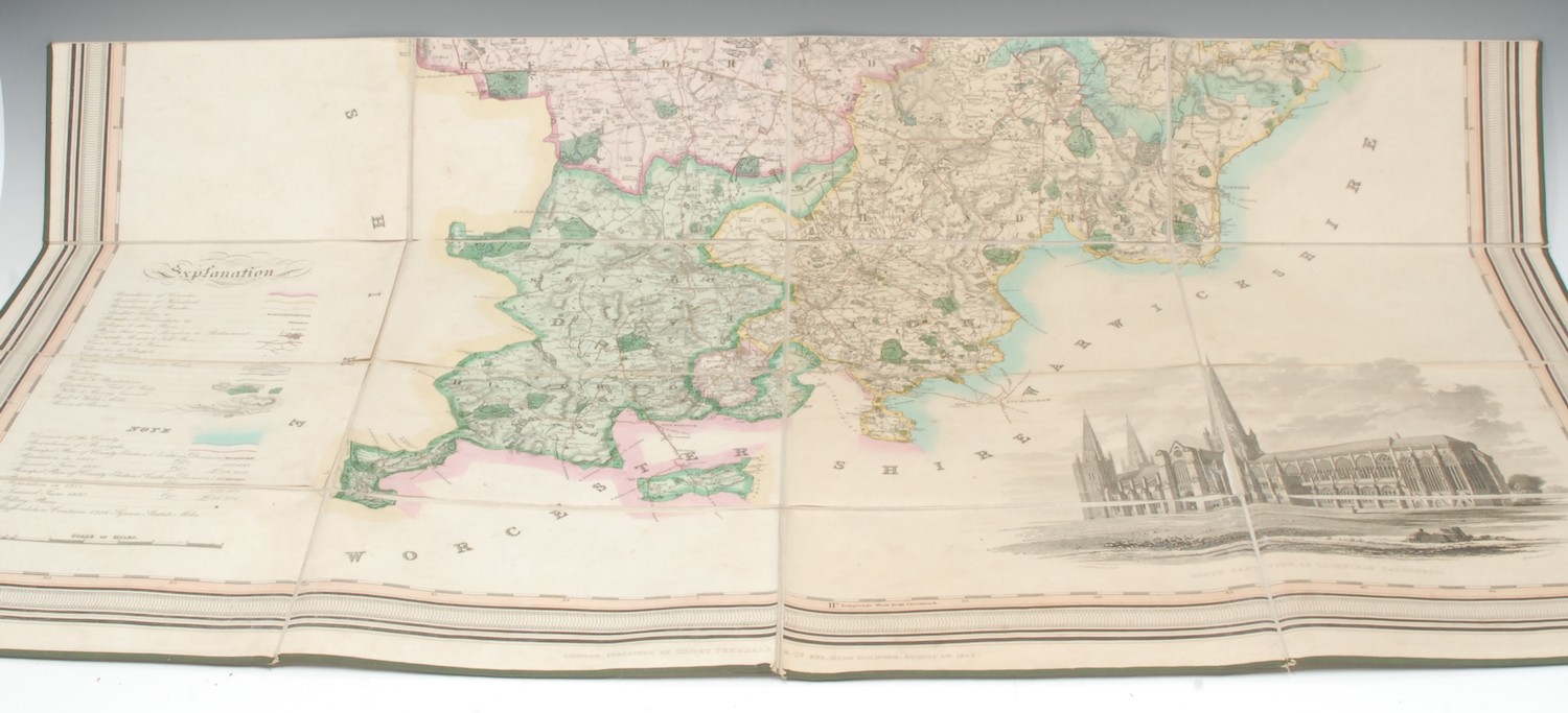
Local Interest - J. Dower, after Phillips (J.) and W.F. Hutchings, A Map of the County of Stafford, Divided into Hundreds & Parishes, From an accurate Survey, Made in the Years 1831 and 1832, London: Published by Henry Teesdale & Co., August 1st, 1832, named-view architectural vignette of Lichfield Cathedral to the lower-right, hand-coloured engraving over forty-folds, laid on linen, the margins green silk-mounted, 137cm x 100.5cm, contemporary calf book-shaped library case (chipped and worn), marbled edges, push-cover, 27.5cm high, [1]
Fees apply to the hammer price:
Free Registration
28.8% inc VAT*
Flat Fee Registration
25.20% inc VAT*