
€20
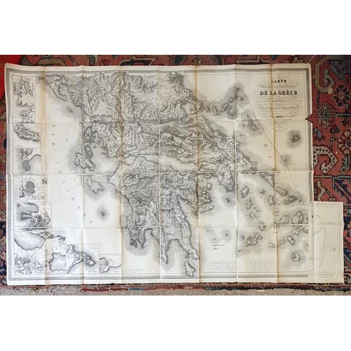
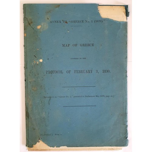
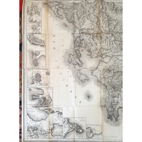
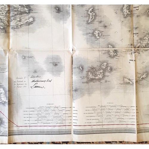
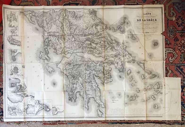
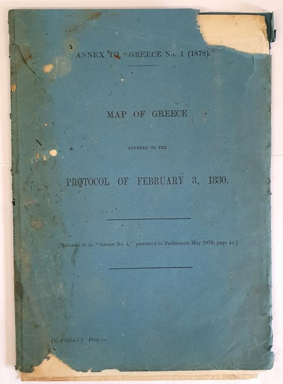
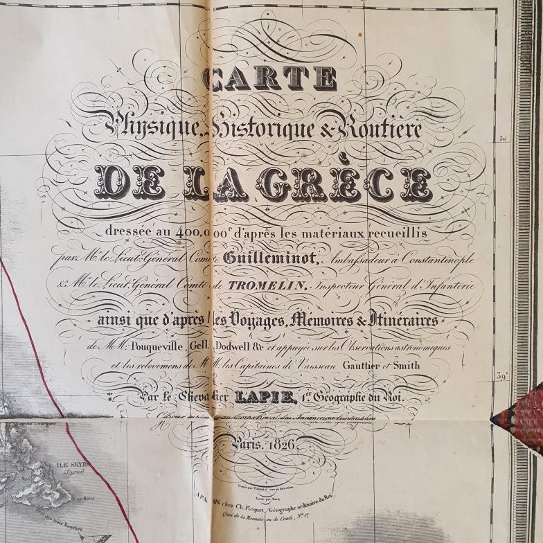
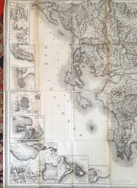
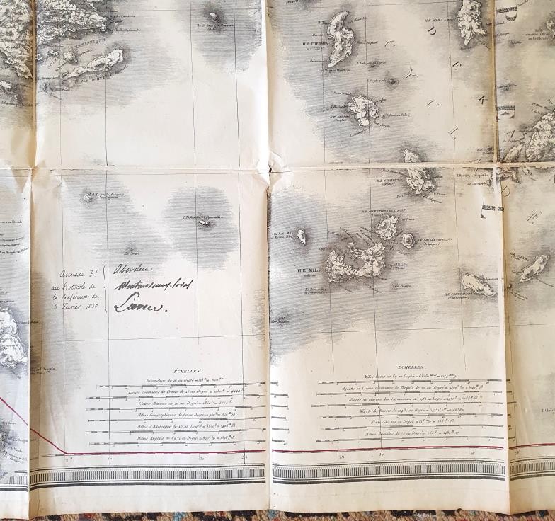
Greece: Huge Map: Lapie Carte physique, historique & routiere de la Grece …. Paris, 1826 … photozincographed [ie. reproduced] Southampton at Ordnance Survey, 1878. 112 x 155 cms. plus an additional fold out section at bottom right corner, 9 more detailed local maps in insets at left side, bold hill shading to show mountains. Folding and contained in original printed envelope. Apparently used as the basis for an international treaty. Very striking map.
Fees apply to the hammer price:
Free Registration
28.69% inc VAT*
Flat Fee Registration
25.00% inc VAT*