


£280
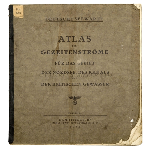
A RARE THIRD REICH SUBMARINE ATLAS FOR THE BRITISH ISLES, 1936
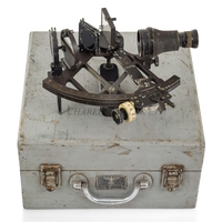
entitled Deutsche Seewarte, Atlas der Gezeitenströme für das Gebiet Der Nordsee, Das Kanals Und Der Britischen Gewässer, E.S. Mittler & Sohn, 1936, 14 maps of northern Europe (Great Britain featuring in all of them), the land depicted in light green, lower fore-corners dogeared with usage and with some tears, original printed wrappers, library stamp on title of a department of the Kriegsmarine -- 18½ x 20¼in. (47 x 51.5cm) contained in green card case
(2)
Fees apply to the hammer price:
Free Registration
32.4% inc VAT*
Flat Fee Registration
28.80% inc VAT*