


£420
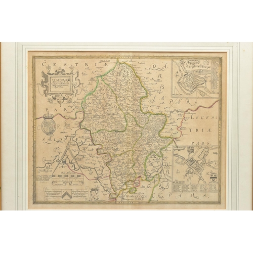
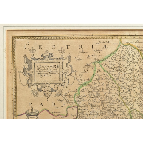
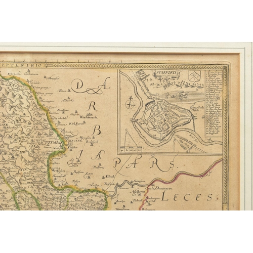
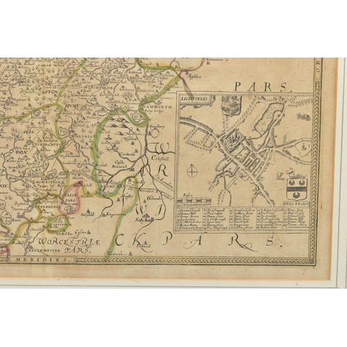
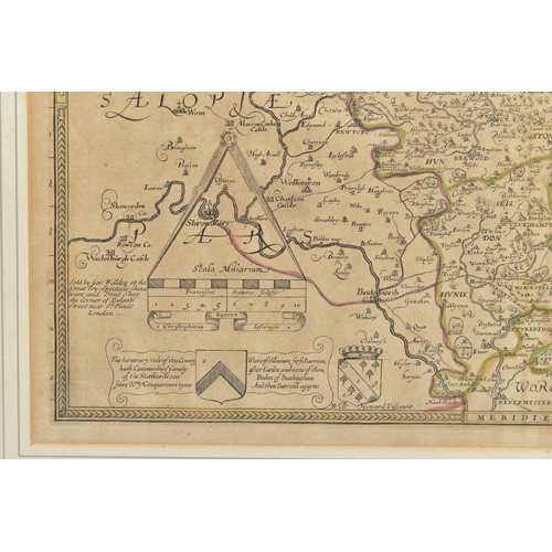
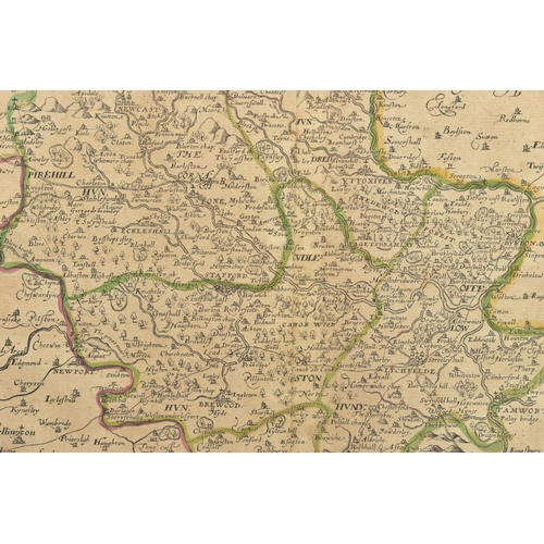
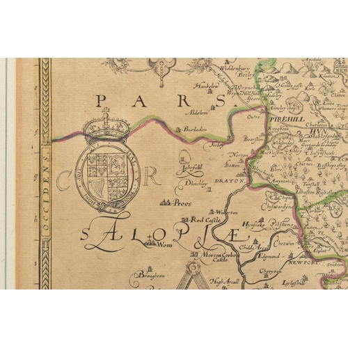
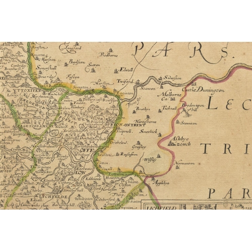
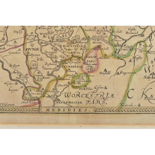
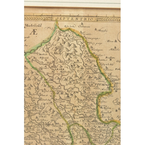
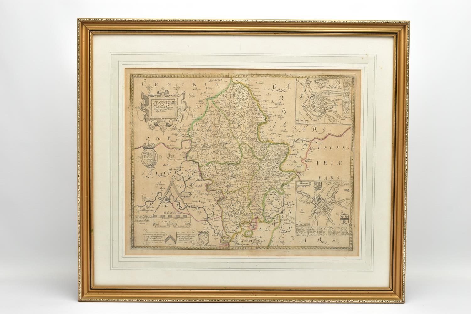
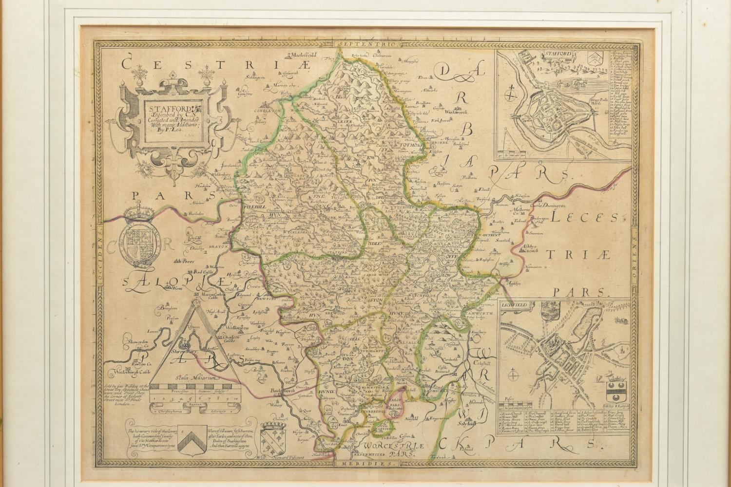
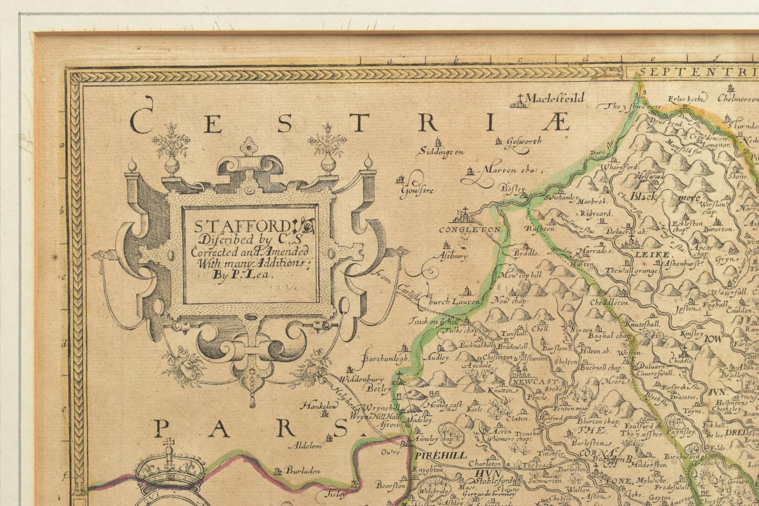
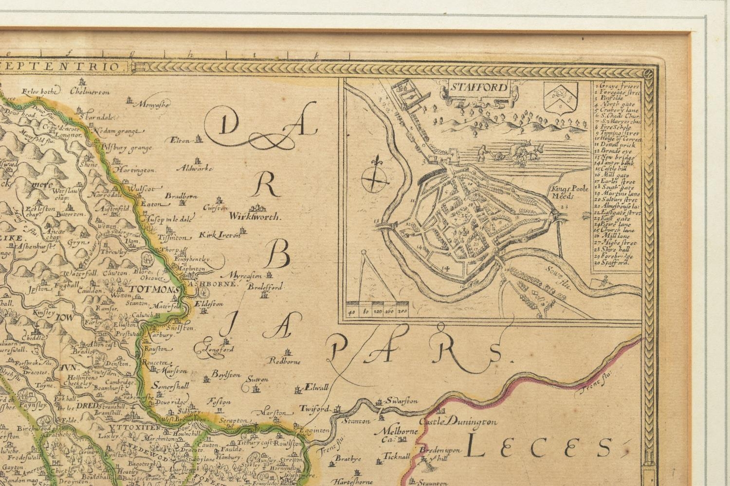
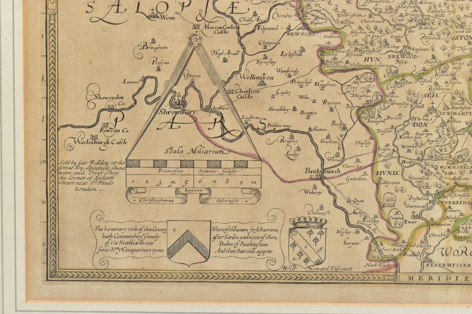
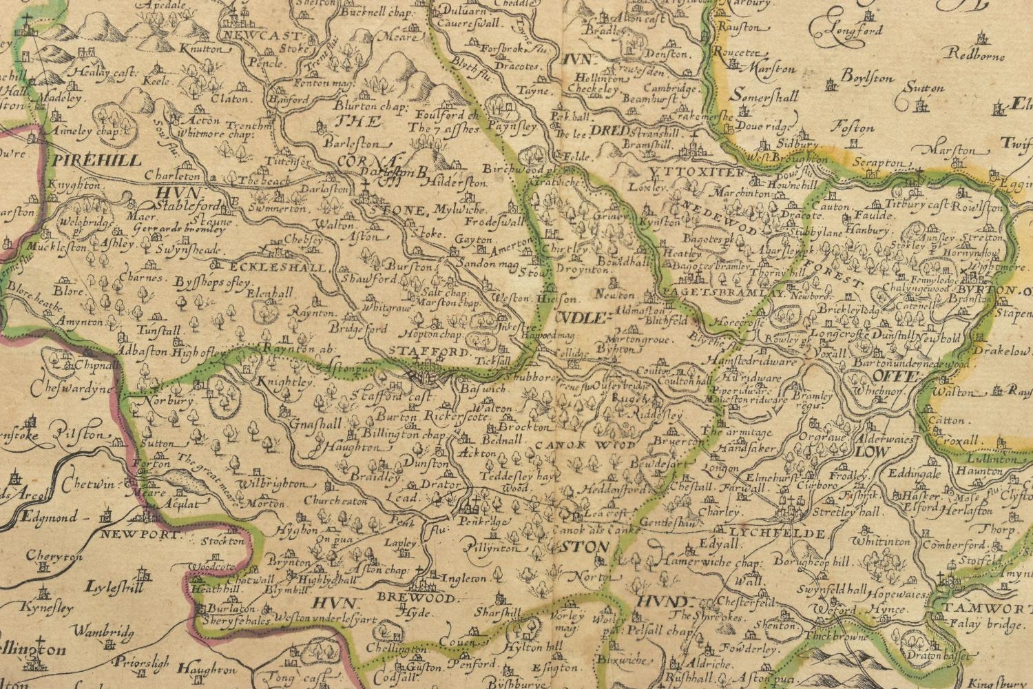
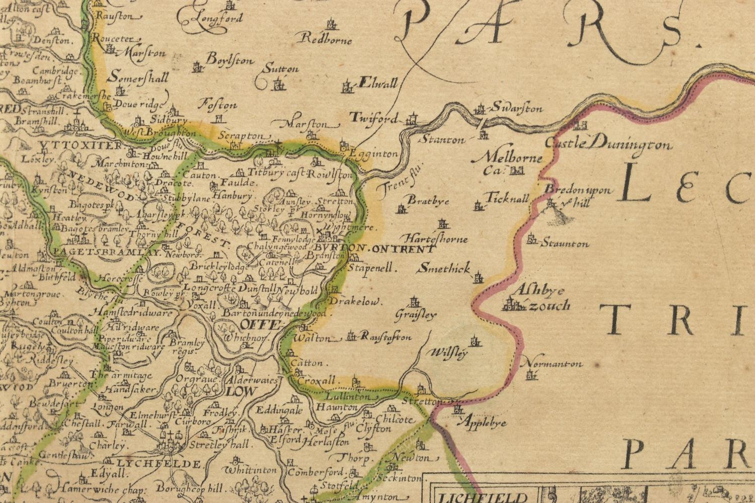
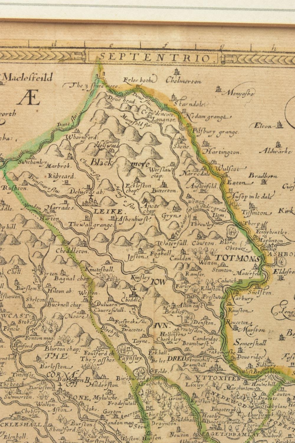
STAFFORDSHIRE, CHRISTOPHER SAXTON & PHILIP LEA, a 17th Century map with plans of Stafford and Lichfield to the right hand side, hand coloured outlines, in card mount, framed and glazed, map 41.2cm x 52cm (Condition report: the centre fold is overlapping down the majority of the map, some areas of discolouration)
Fees apply to the hammer price:
Free Registration
27.6% inc VAT*
Flat Fee Registration
24.00% inc VAT*