£250
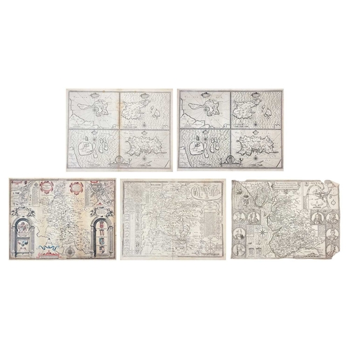
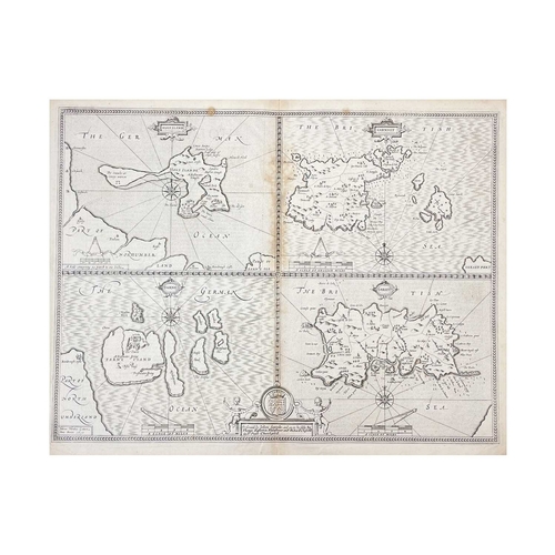
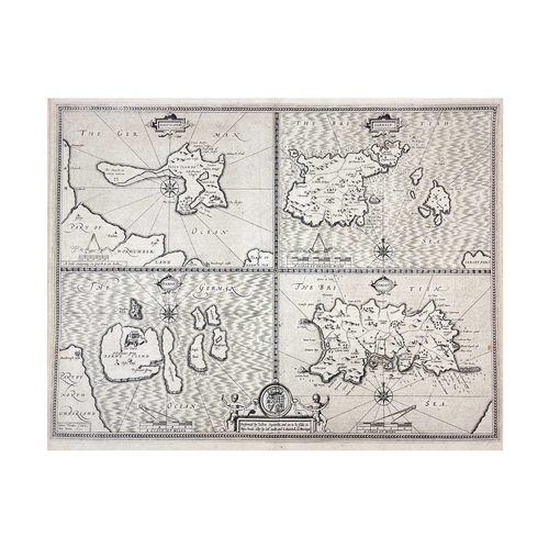
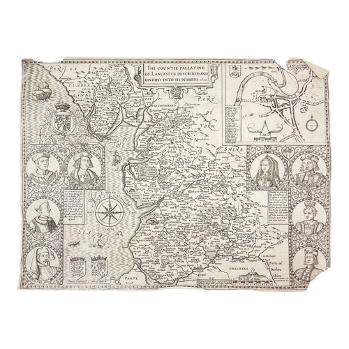
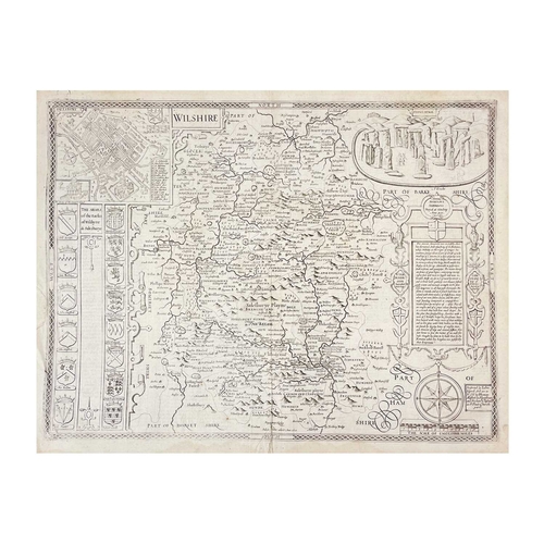
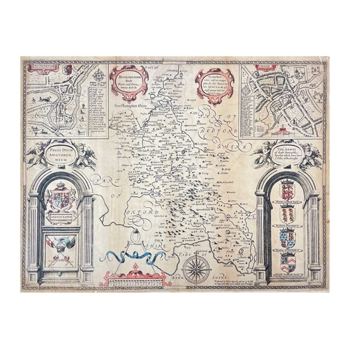
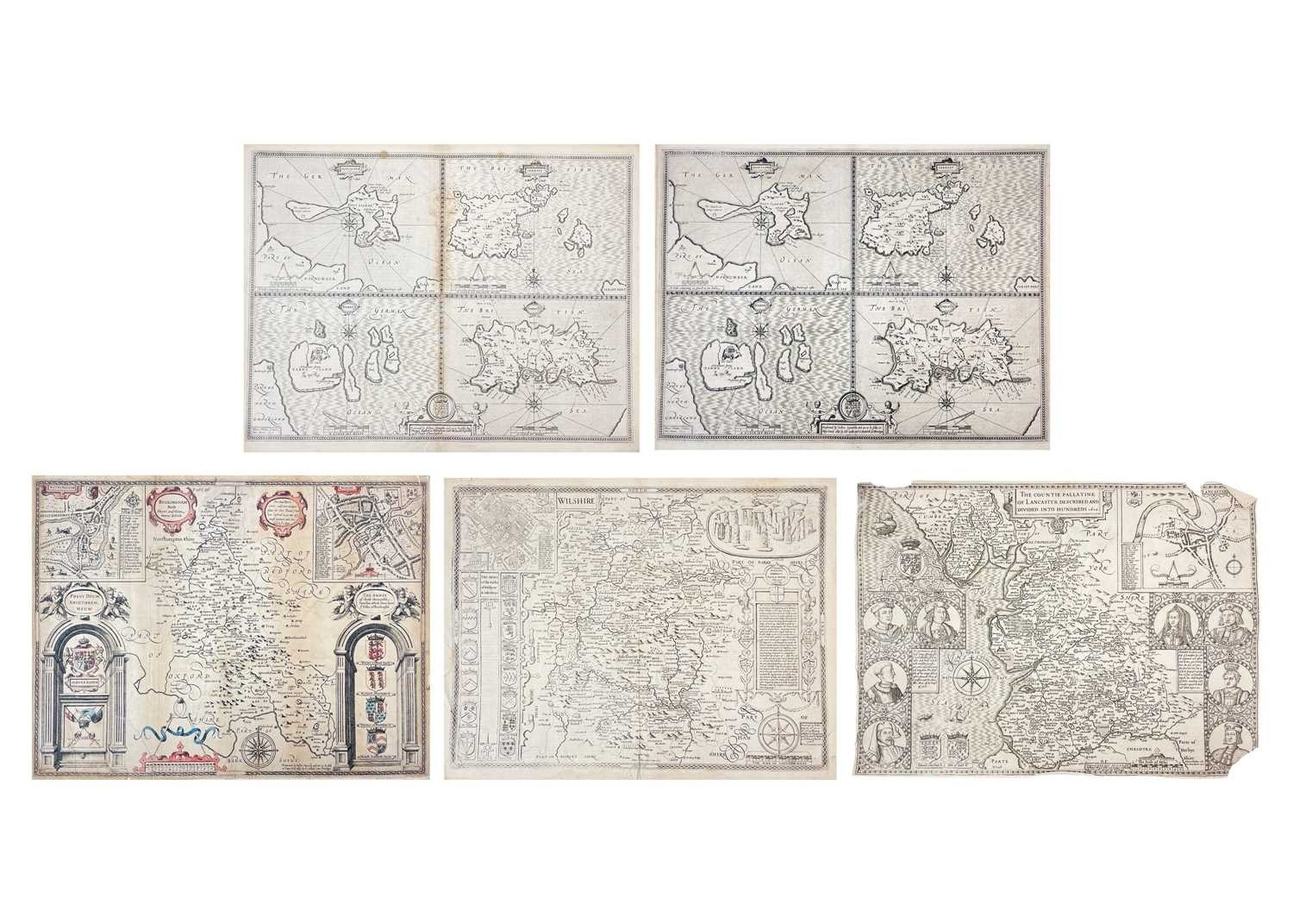
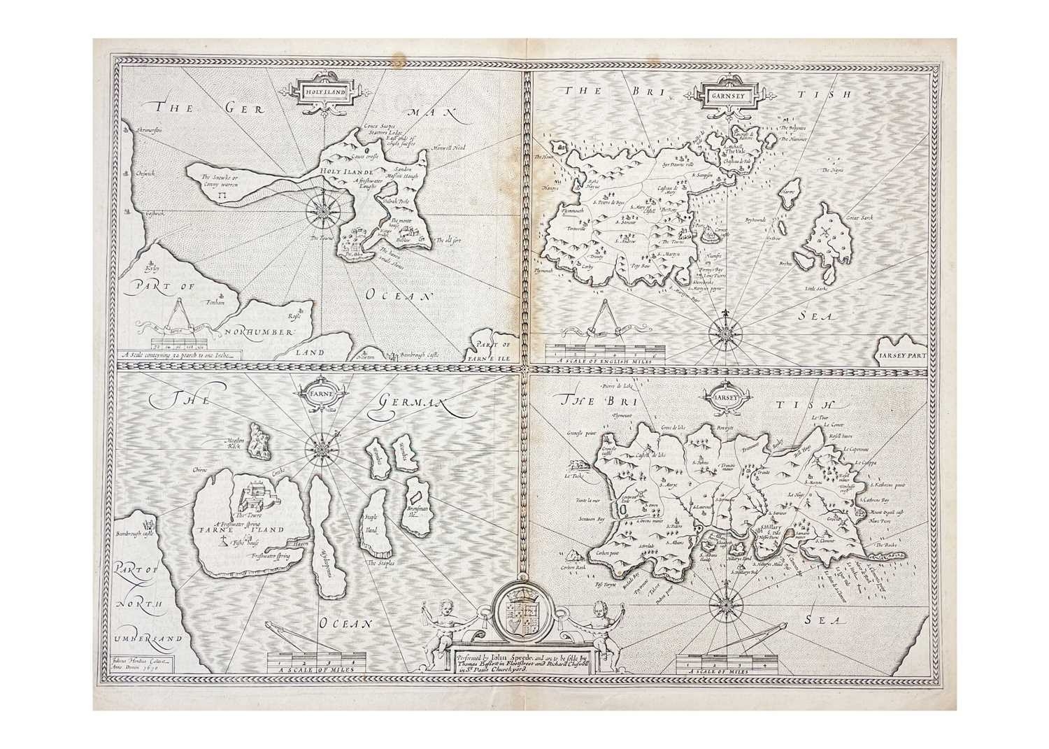
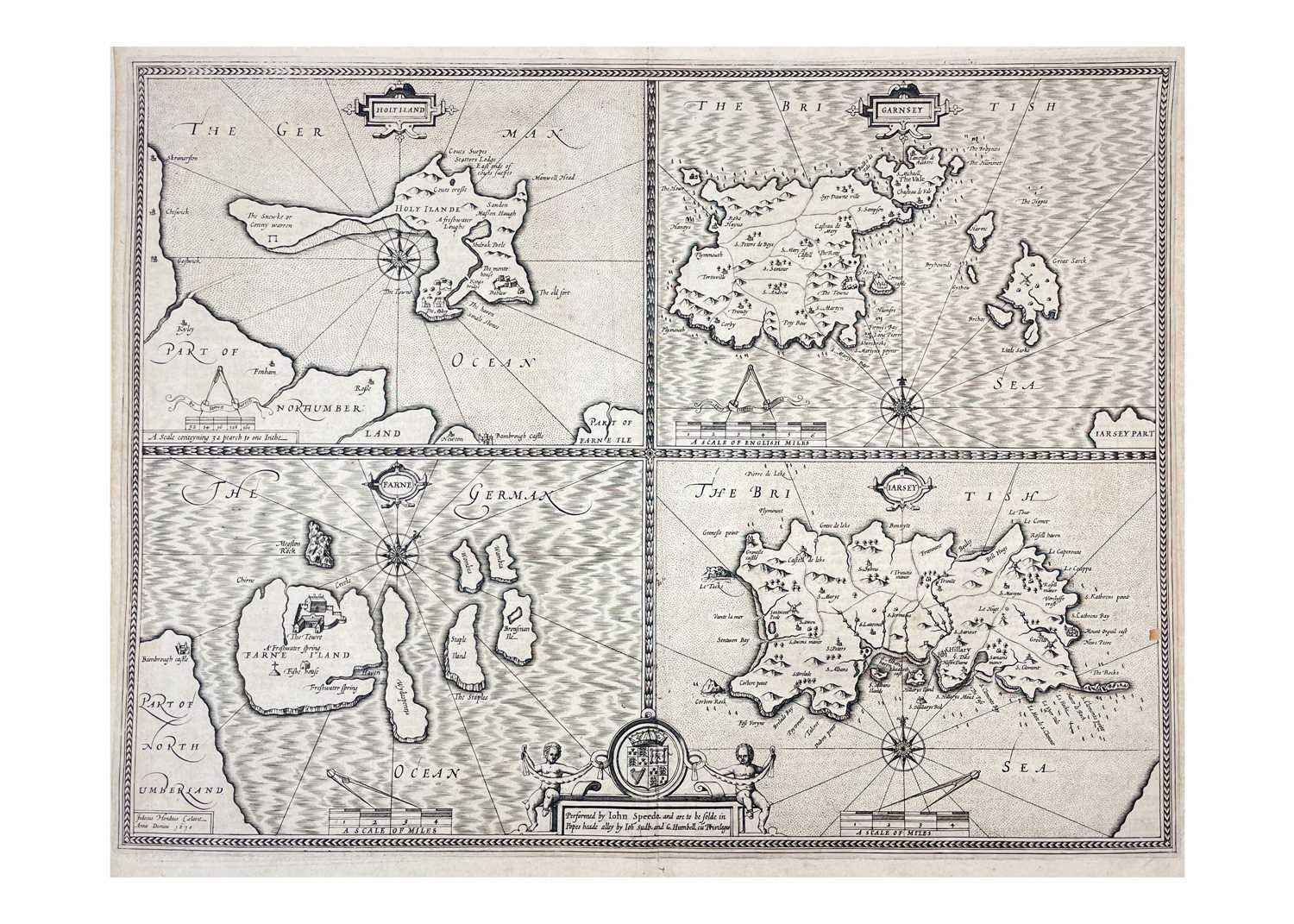
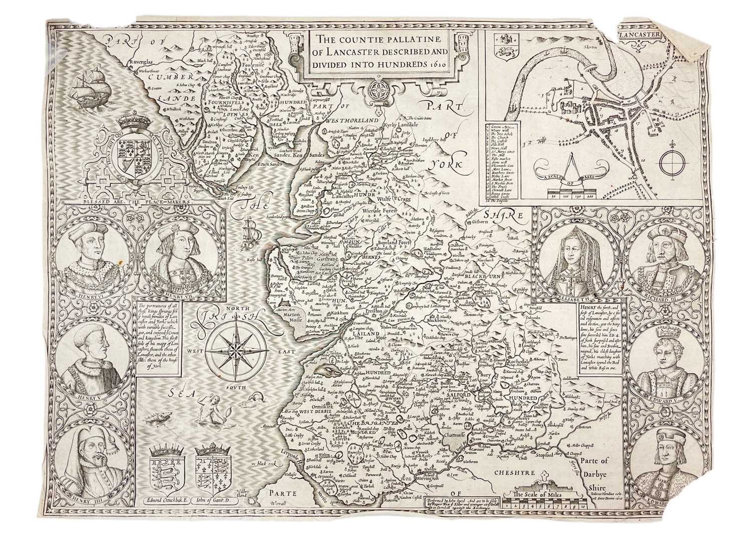
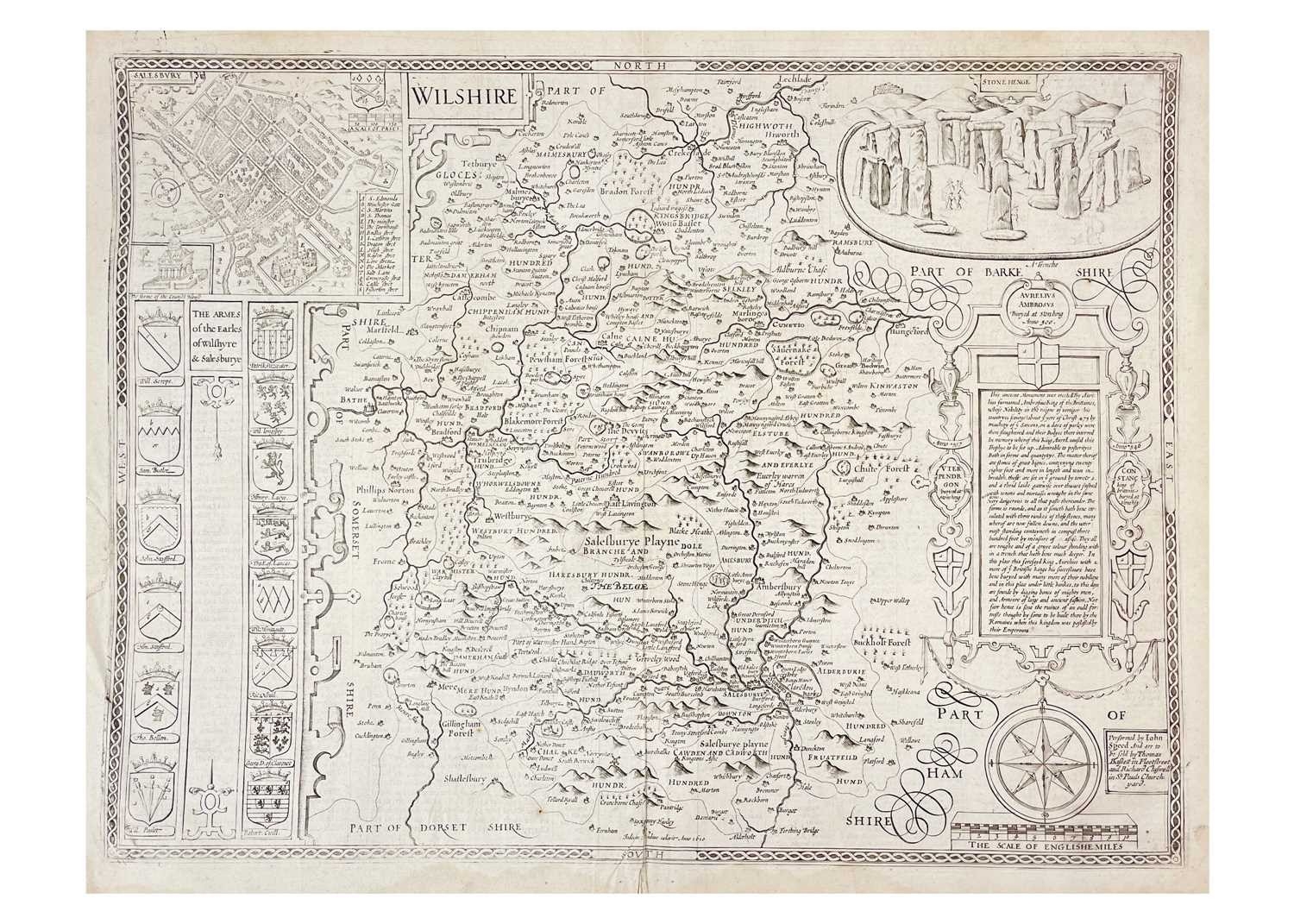
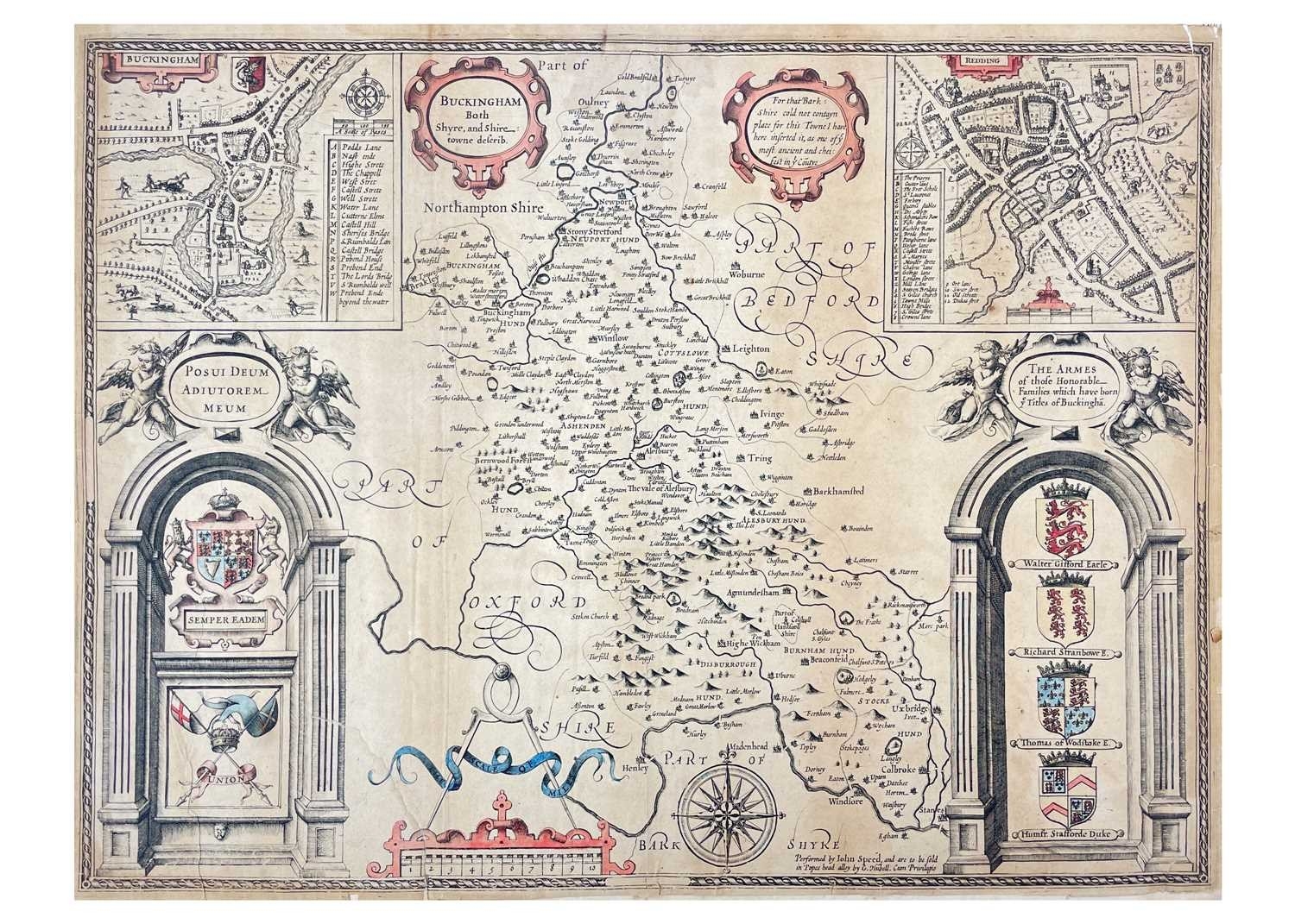
John Speed (1551/2–1629) Five copper engraved maps 'The Countie Pallatine of Lancaster Described and Divided Into Hundreds 1610,' uncoloured copper engraved map, featuring an inset map of Lancaster with landmark key in the upper right corner, and eight royal portrait, tears with loss to margins, Roger & Rea, London, Roger Rea, 1610 [1662]; 'Wilshire,' uncoloured copper engraved map, small nibble and repair to margin, centre fold, inset engraving of Stonehenge and Salisbury, English text to verso, Thomas Bassett & Richard Chiswell [1676]; John Speed after Jodocus Hondius. The Lands (sic), i.e. Holy Island and The Farne Islands, Northumberland, and the Channel Islands, Gurnsey and Jersey, double-page map, letter-press to verso, s.l., some toning, centre fold, dated 1610 within the plate; With one other copy; 'Buckingham Both Shyre, and Shire towne described,' partial coloured copper engraved map, inset plan of Redding, condition issue, toned and brittle, small loss to margins, G. Hubell, London, 1610 [?1627]; Largest measures 44cm x 54cm. (5)
Fees apply to the hammer price:
Free Registration
28.8% inc VAT*
Flat Fee Registration
25.20% inc VAT*