£65
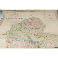
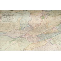
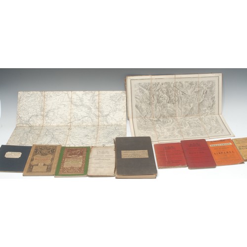
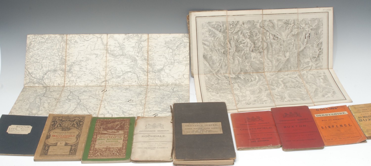
Local Interest - The Ordnance Map of Ashbourn (sic, Ashbourne) and the Neighbourhood, No. LXXII, Printed from one in Electrotype, Tower of London: Ordnance Map Office, July 5th, 1833, eight-folds laid on linen, monochrome engraving, 35cm x 40cm, contemporary tartan printed wrappers, (1); another, similar, Ordnance Survey: Buxton and Matlock, No. LXXXII S.W., Printed from an Electrotype, Tower of London: Ordnance Map Office, 1862, twenty-four-folds, monochrome engraving, 94cm x 76cm, contemporary black boards (upper-cover detached), supplied by Edwin Slater (Late Simms), Manchester, his ticket, (1); Buxton and Leek, including Bakewell, Haddon Hall, Edensor and Wildboarclough, [mid-19th century?], eight-folds laid on linen, engraving, 31cm x 46.5cm, contemporary black wrappers, (1); further early 20th century and later Ordnance Survey, including 1902 Buxton and Chesterfield (2), 1903 Rochdale (1), 1914 Macclesfield and District & Derby, Nottingham and Leciester (2), Chapel en le Frith [n.d.] (1); etc., (2), [10]
Fees apply to the hammer price:
Free Registration
28.8% inc VAT*
Flat Fee Registration
25.20% inc VAT*