![603 - 18th Century Manuscript Map, Co. LouthManuscript Map, Irish, [Co. Louth] Byrne (Michael)cart. A Map ...](https://content.easyliveauction.com/auctions/images_lots/30DFDC6C9A09053D4FEC911624A8FA03_fon01/1100091787_PREVIEW.JPG)
€250
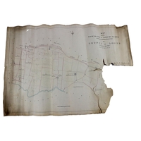
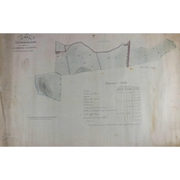
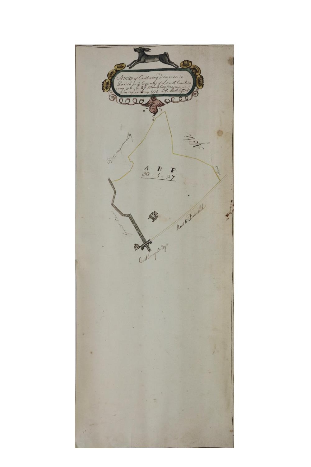
18th Century Manuscript Map, Co. Louth
Manuscript Map, Irish, [Co. Louth] Byrne (Michael)cart. A Map of Castlering Demesne in Parish and County Louth, containing 38a.1r .27P Plantation Measure, surveyed in May 1775, m/ss, hand coloured decorative naïve cartouche, approx. 48cms x 19cms (19" x 7 1/2"), as a map, w.a.f. (1)
Fees apply to the hammer price:
Free Registration
28.69% inc VAT*
Flat Fee Registration
25.00% inc VAT*