R15,000
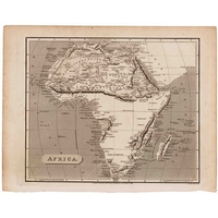
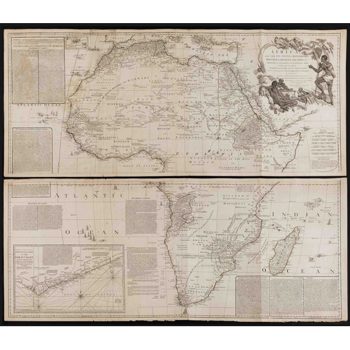
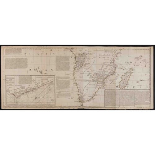
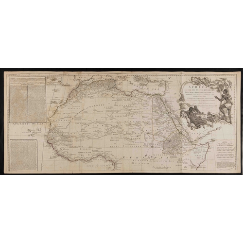
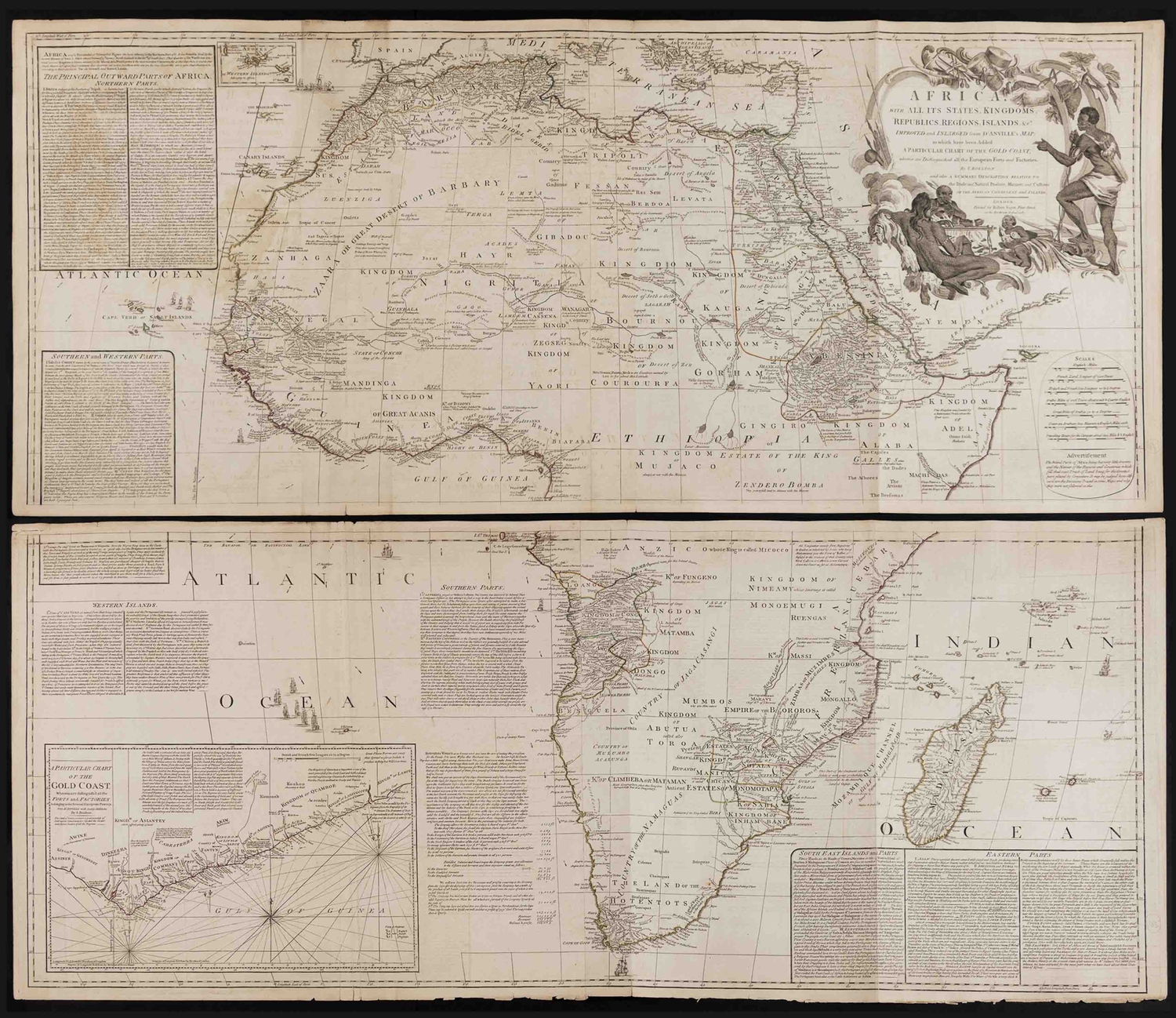
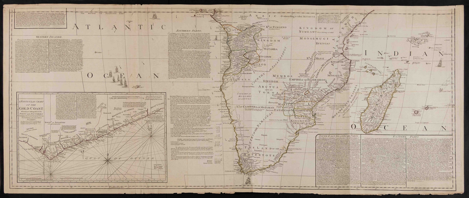
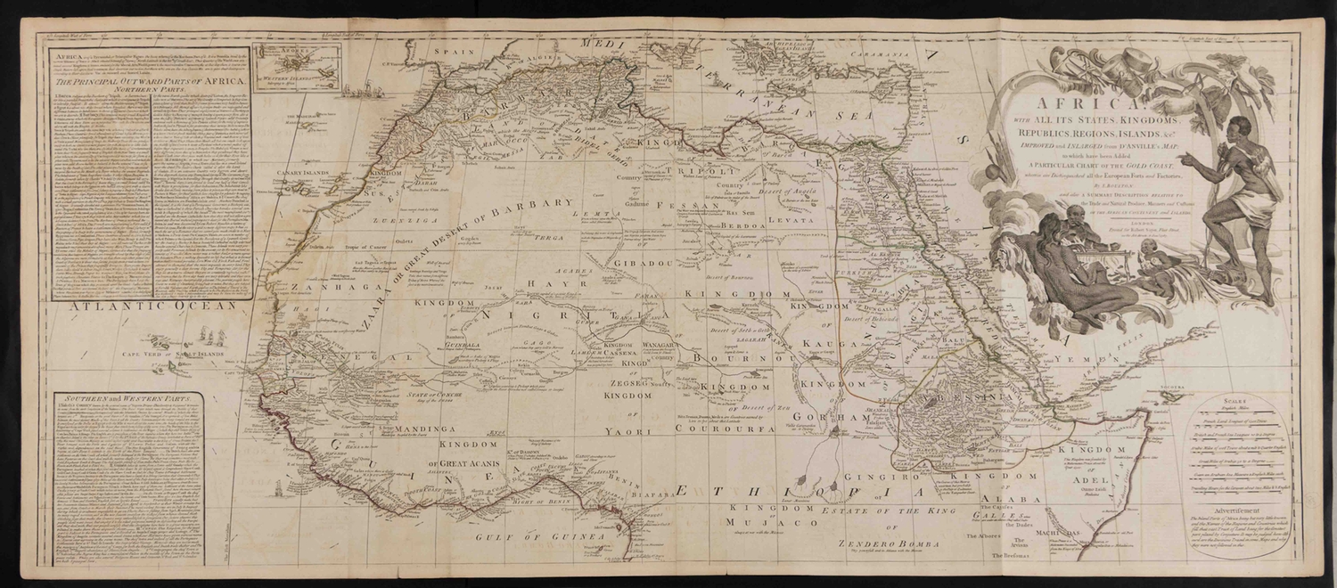
Samuel Boulton - AFRICA WITH ALL ITS STATES, KINGDOMS, REPUBLICS, REGIONS, ISLANDS ETC., TWO WALL MAPS
London: Robert Sayer, (1787) 1787
Copperplate engraving, outline colour, paper watermarked
Southern Africa: three vertical folds, offsetting, short tears at edge along folds, some frittering along bottom edge, 4cm narrow strip of loss in upper left corner margin; verso: foxing on one sheet, light tanning along edges, paint show through, "27" in ink
Northern Africa: three vertical folds, offsetting, short tears at edge along folds; verso: pencil note, paint show through, "26" in ink
both approximately 53 by 122cm
Boulton based these large wall maps on an earlier map by D'Anville, who attempted to include all the accurate scientific knowledge (contemporary and ancient) at the time, hence the large empty areas in the interior of the continent. Boulton enlarged and expanded the map, but followed D'Anville precepts. He stated "The inland parts of Africa being but very little known and the names of the regions and countries which fill that vast tract of land being for the greatest part placed by conjecture it may be judged how absurd are the divisions traced in some maps and why they are not followed in this."
The map also includes a great deal of text with two sections about Southern Africa. Particularly fascinating is the list of salaries of the Company (VOC) employees at the Cape.
LITERATURE
Norwich #105
Fees apply to the hammer price:
Free Registration
| 1 to 10000: | 26.45% inc VAT* |
| 10001+: | 23% inc VAT* |
Flat Fee Registration
| 1 to 10000: | 23% inc VAT* |
| 10001+: | 19.55% inc VAT* |