£260
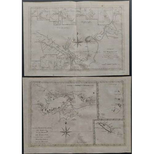
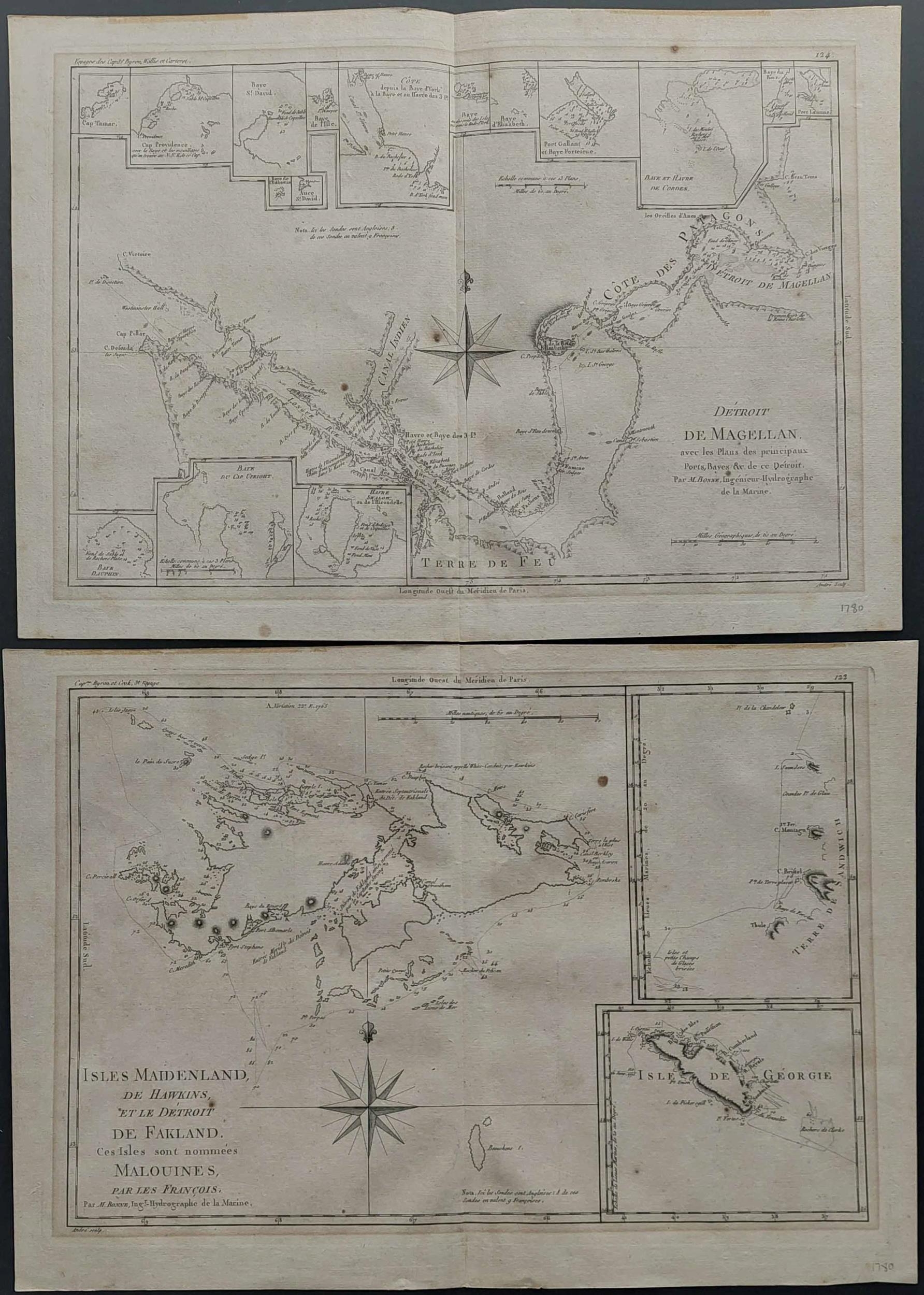
EARLY MAPS OF THE FALKLAND/MALVINAS ISLANDS - SHOWING S. SANDWICH & GEORGE IS., ETC.; 1780 pair of folding engraved M. Bonne maps (11x15 ins.; minor toning and a couple of spots - central folds as usual) from the 'Atlas des toutes les parties connues du globe terrestre' by Guillaume Raynal; one showing "ISLES MAIDENLAND, DE HAWKINS, ET LE DETROIT DE FALKLAND. Ces Isles nommees MALOUINES par les Francois" (with small insets of the Sandwich & George Is.), the other showing "DETROIT DE MAGELLAN" (with no less than 14 inset detail maps). They also show the routes of some famous exploration voyages (inc. those of Captains Cook, Byron, Carteret & Wallis). Rare pair. [Ex Cavendish Feb. 2019 auction; lot 95 realised £160+BP.] [Ex Michael Manning.] (2 maps)Cross Reference: MAPS, ARGENTINA
Fees apply to the hammer price:
Free Registration
24% inc VAT*