


£55
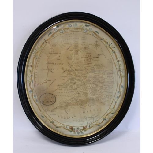
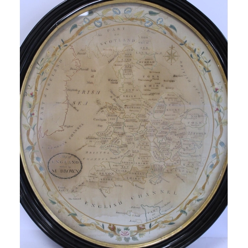
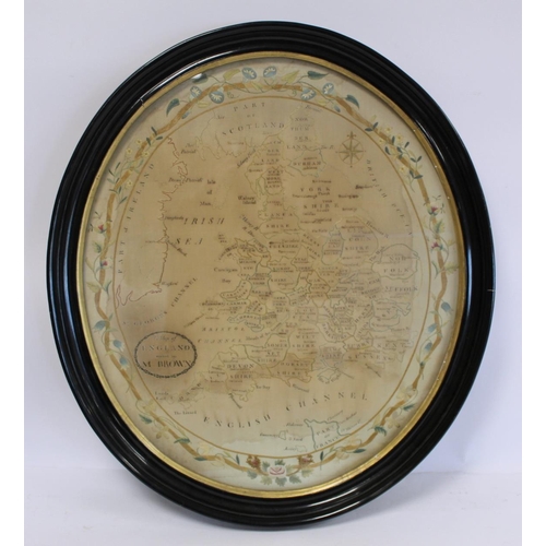
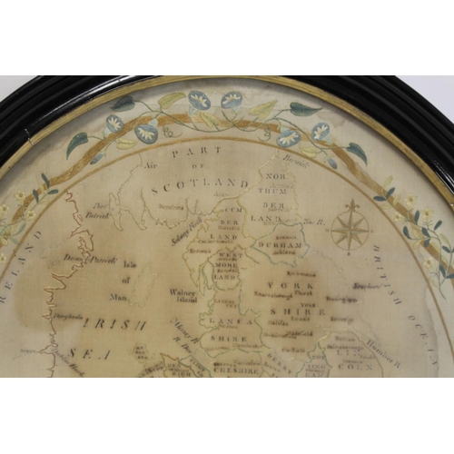
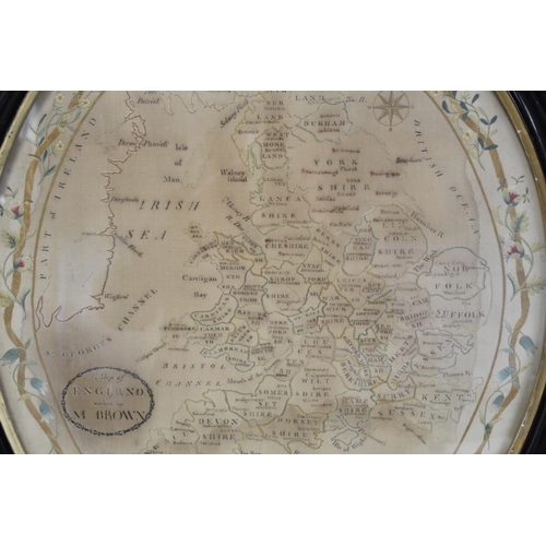
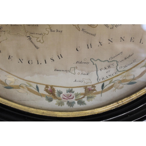
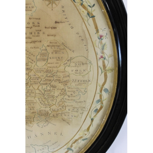
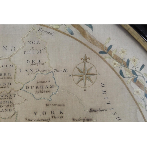
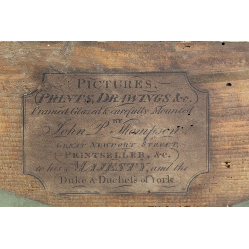
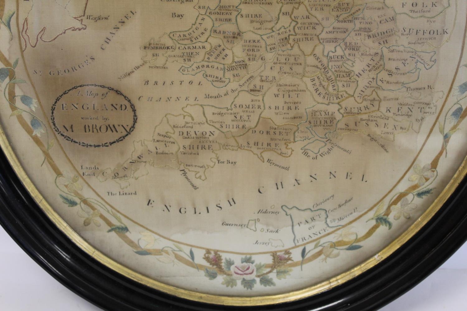
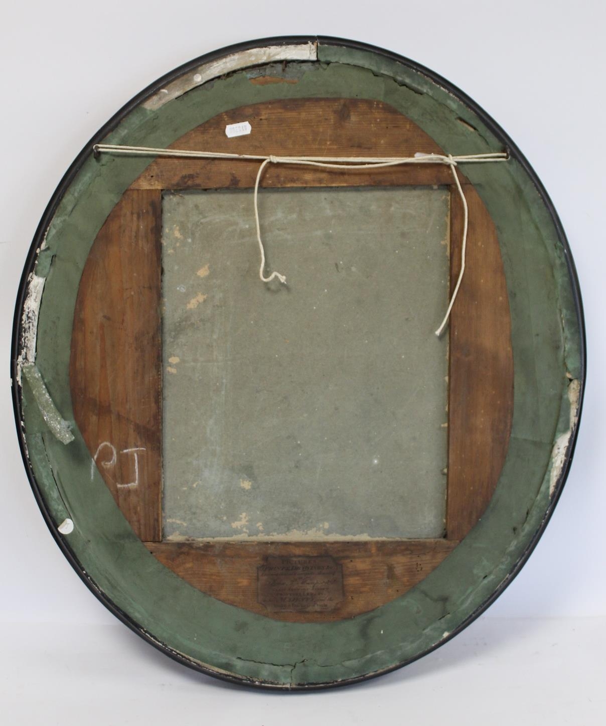
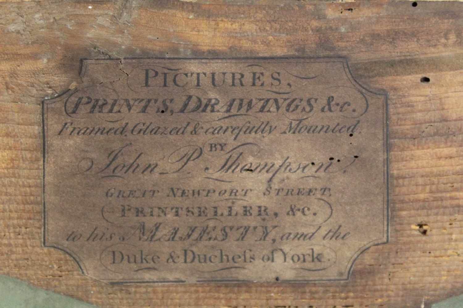
Georgian embroidered map of England and Wales worked in polychrome silk threads on natural fine silk or linen ground, the counties, towns, etc. are noted in manuscript sepia ink, also including outlines of part of Scotland, part of Ireland, part of France, English Channel & Islands, Irish Sea at St. George's Channel and the British Ocean, surrounded by a floral and foliate scroll border, with oval cartouche inscribed "A map of England worked by M. Brown", label verso for John P. Thompson, print seller, Great Newport Street, London, c.1792-1813, 57cm x 49cm (oval), in ebonised frame with gilt border.
Fees apply to the hammer price:
Free Registration
27.6% inc VAT*
Flat Fee Registration
24.00% inc VAT*