£30
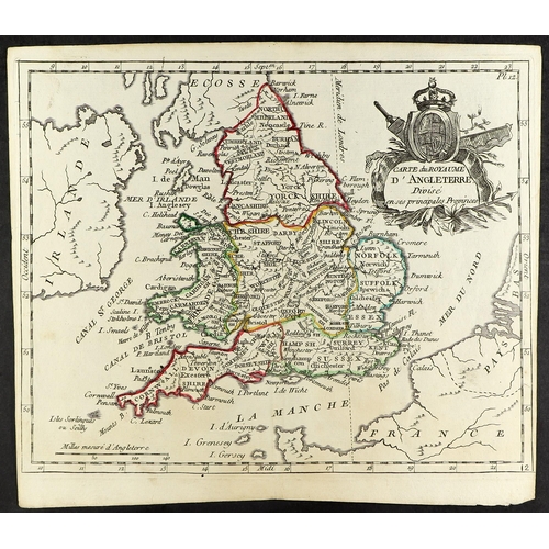
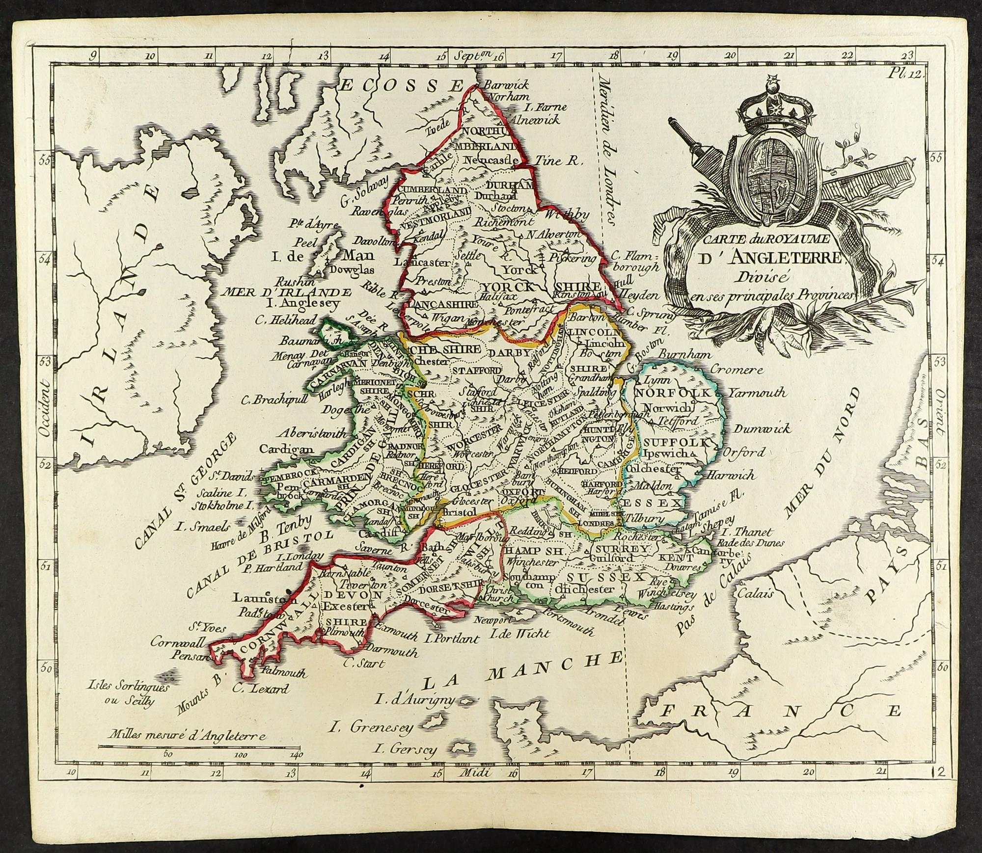
19TH CENTURY MAP OF ENGLAND Circa 1806 engraved map by DE LAPORTE of Paris, most attractive showing the counties of England and Wales, the coastlines of France and Ireland, and coloured to show the regions e.g. South West, Midlands, East Anglia, etc. In good condition, approx size 230 x 200mm.
Fees apply to the hammer price:
Free Registration
25.6% inc VAT*
Flat Fee Registration
22.00% inc VAT*