TWO FRAMED MAPS OF IRELAND: (i) Carte du Royaume D’Irande, h...

by Hegarty Antiques and Fine Art Auction Rooms
1/6

Estimate

€150 - €250

Fees

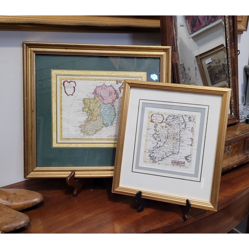
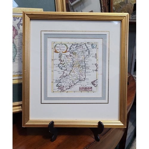
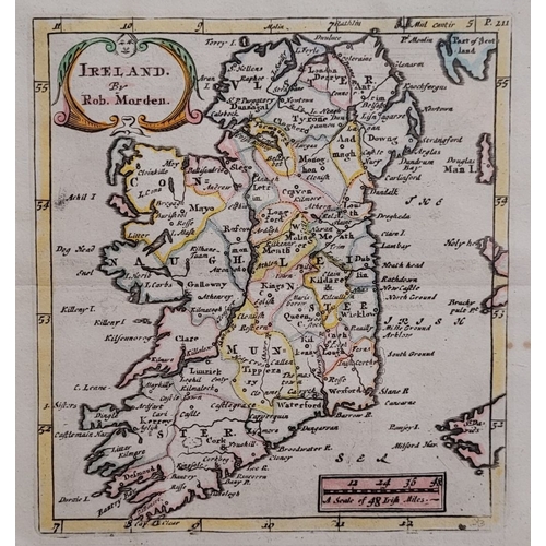
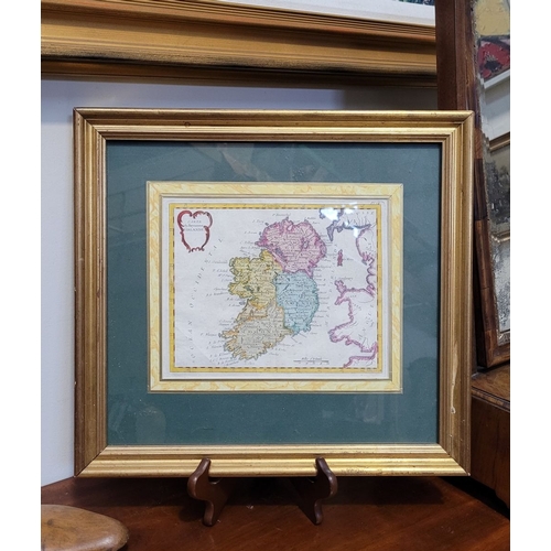
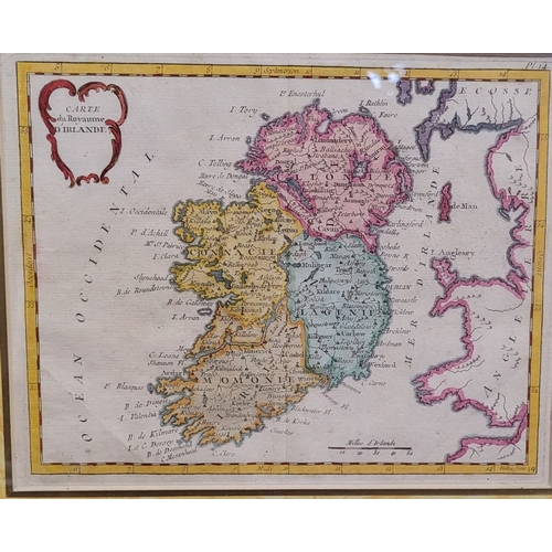
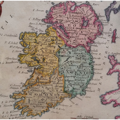
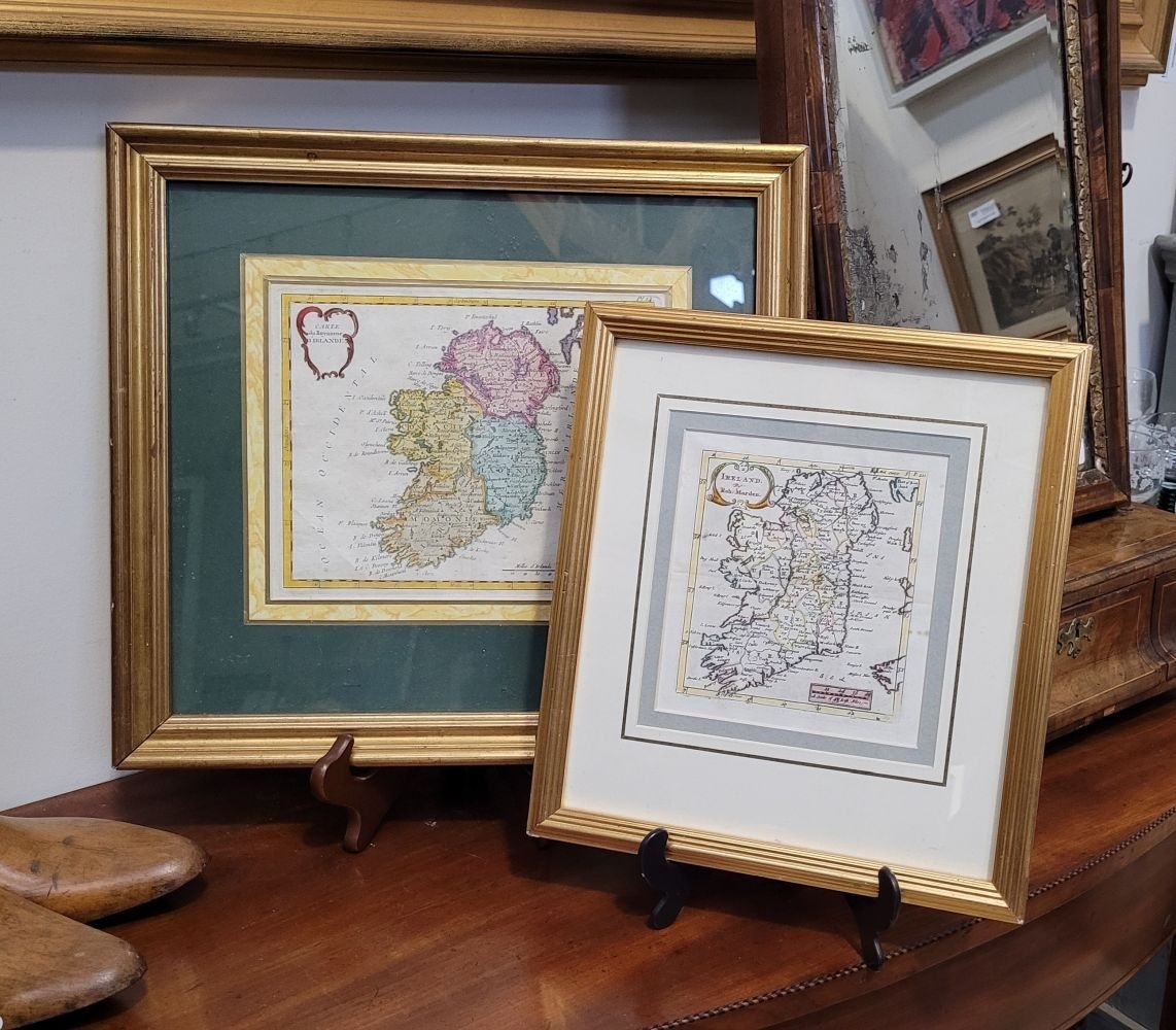
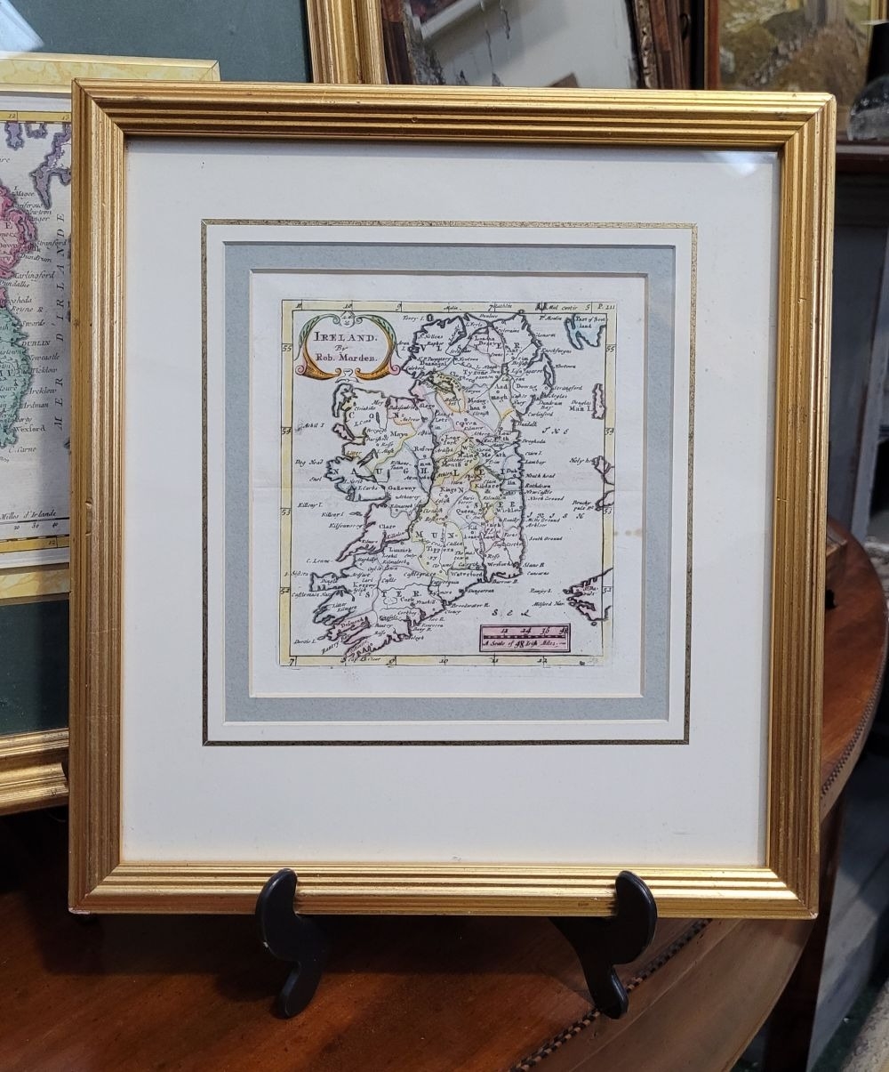
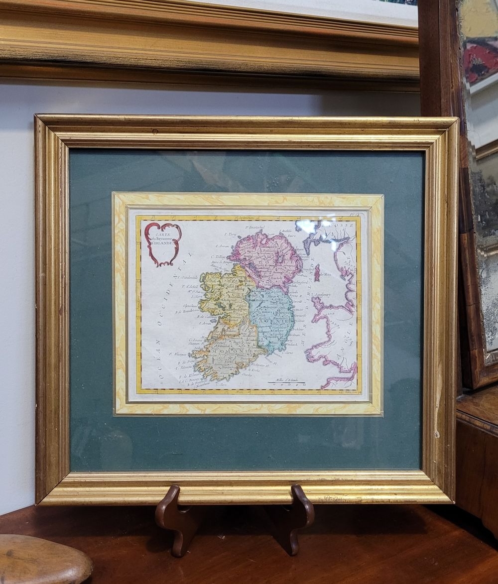
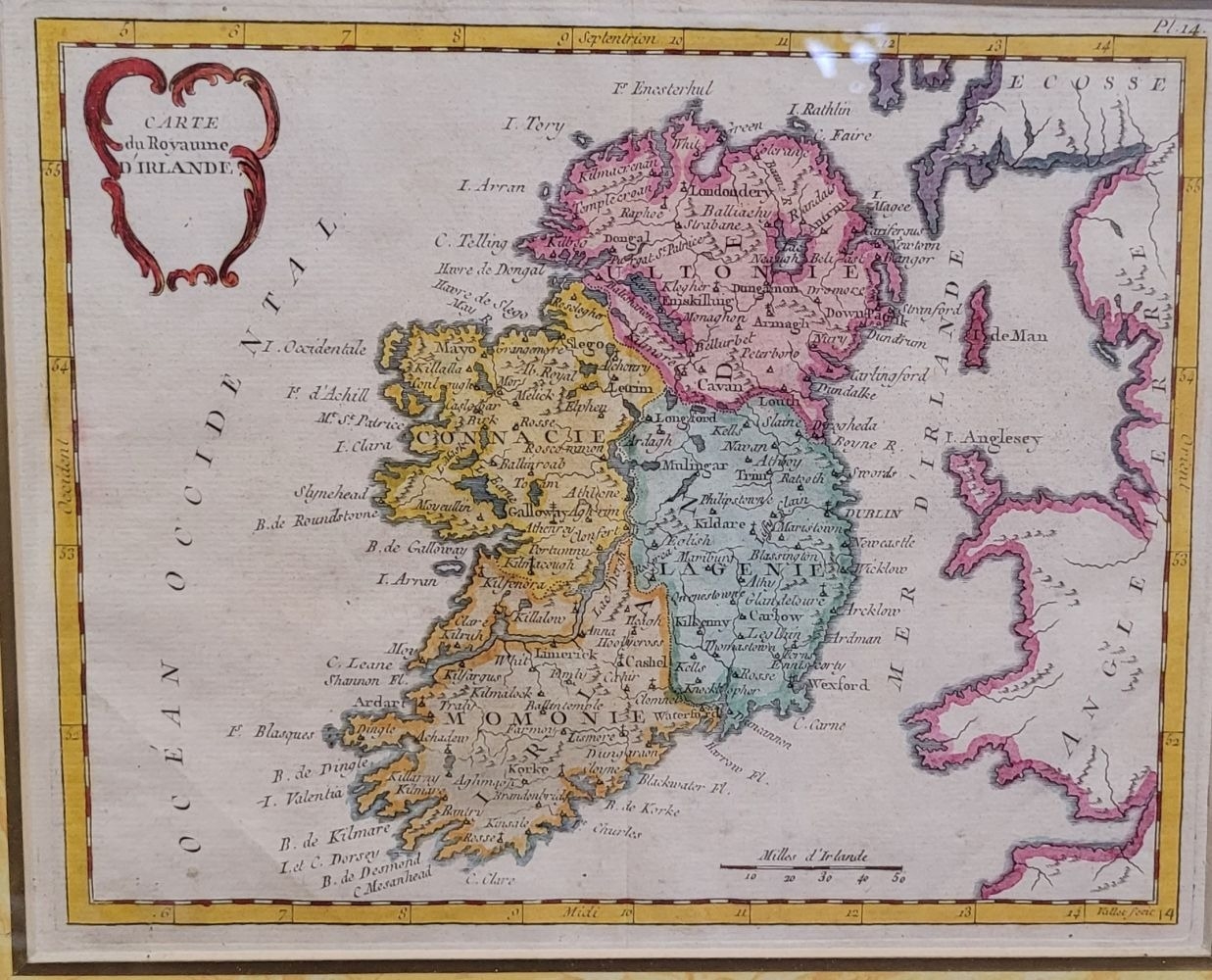
TWO FRAMED MAPS OF IRELAND: (i) Carte du Royaume D’Irande, hand coloured framed map of Ireland, divided into provinces. Plate 14. Showing towns, rivers etc. Frame: 40 x 37cm, map: 22 x 17cm. (ii) Ireland, by Robert Morden, from Geography Anatomised, 1699. Frame: 30 x 27.5cm, map: 13 x 12cm (2).

Closed
Auction Date:
19th Feb 25 at 11am GMT

Fees apply to the hammer price:

Free Registration
34.44% inc VAT*

Flat Fee Registration
30.75% inc VAT*

*These fees include buyers premiums and internet surcharges.
Please see the auctioneers terms & conditions for more information

Other Lots in this Auction

Hegarty Antiques and Fine Art Auction Rooms

Sale Dates:
Wed 19th Feb 2025 11am GMT (Lots 1 to 290)