£70
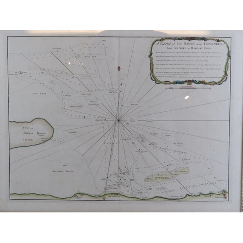
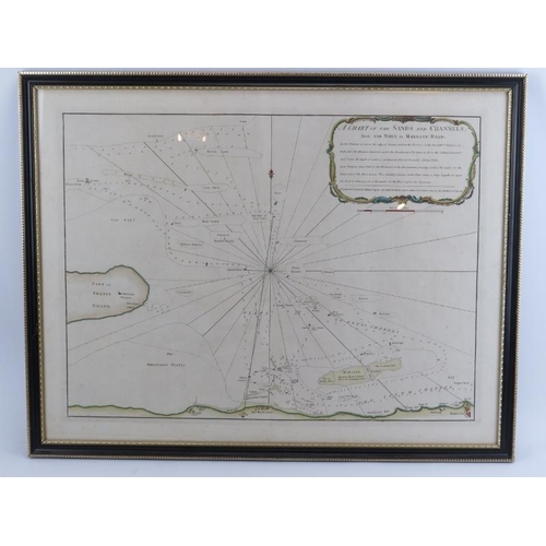
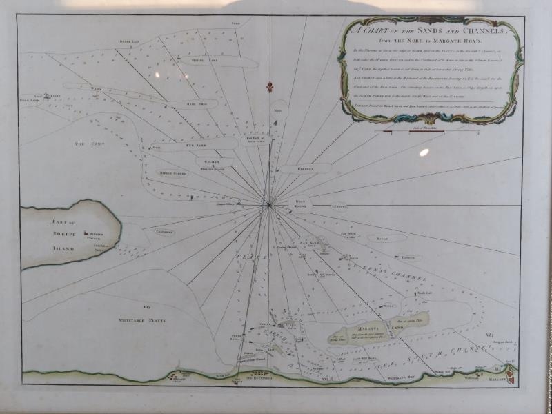
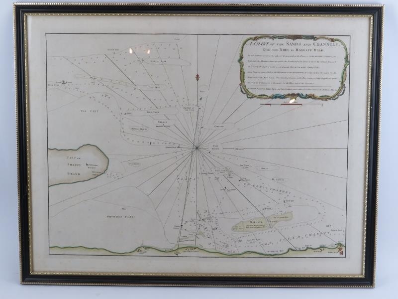
A Thames Estuary Sea Chart by R Sayer & J Bennett, dated 1779. A chart of the sands and channels from the Nore to Margate Road. Hand coloured engraving. Glazed and framed. 20.5 in (52 cm) x 26.8 in (68 cm).
Condition report: Good condition with only minor wear with age.
Fees apply to the hammer price:
Free Registration
26.4% inc VAT*
Flat Fee Registration
22.80% inc VAT*