£150 - £200
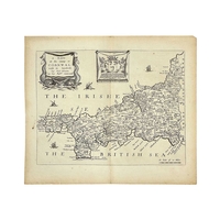
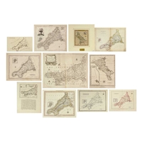
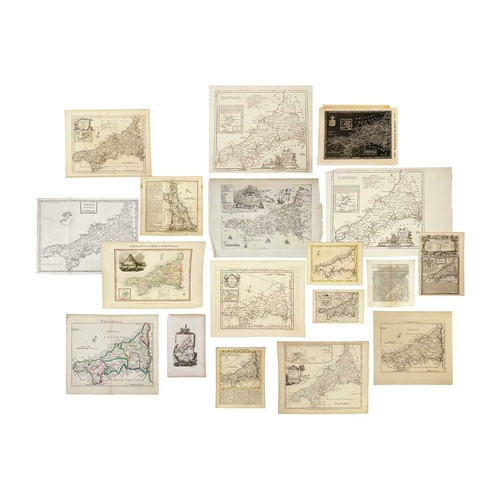
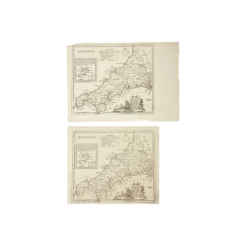
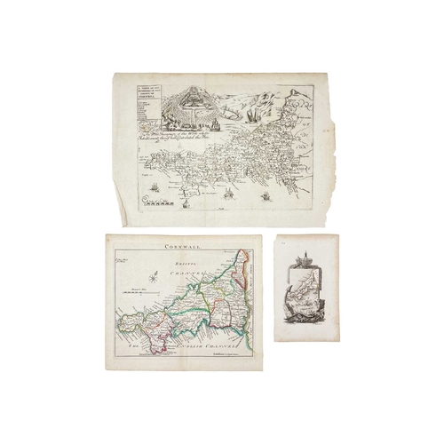
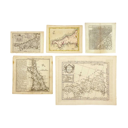
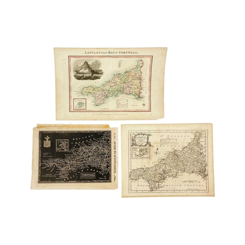
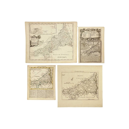
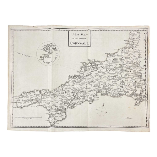
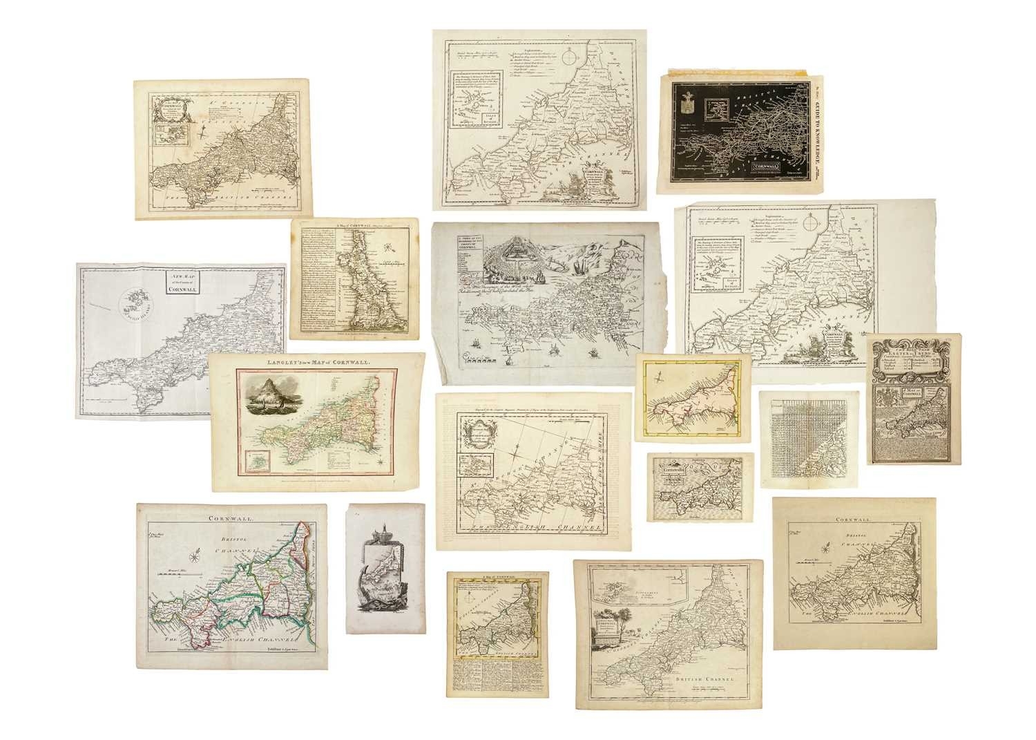
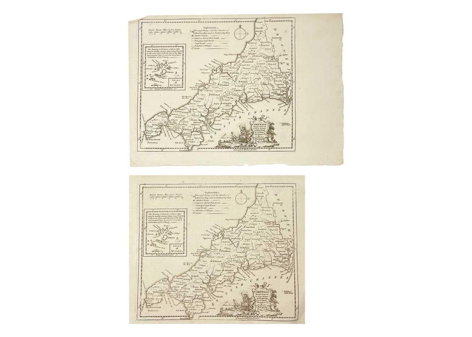
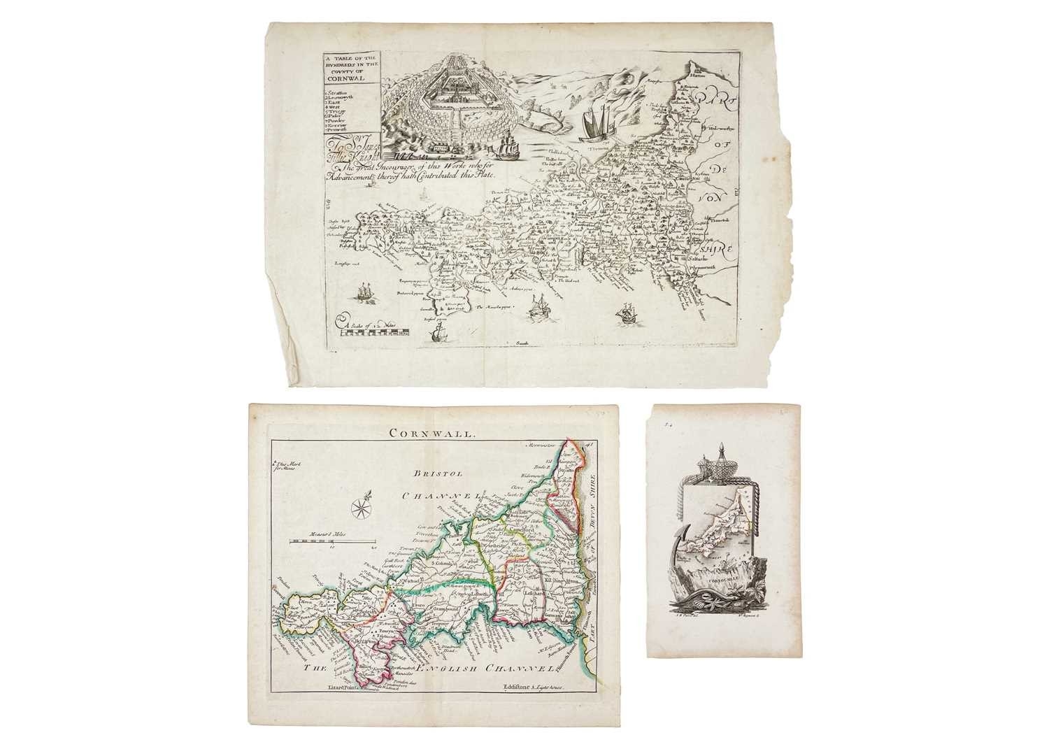
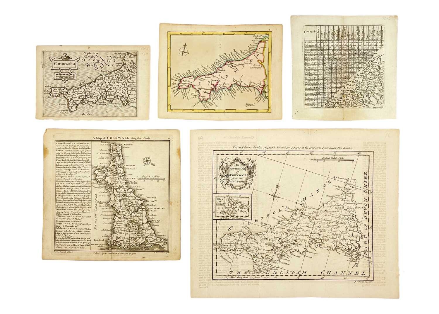
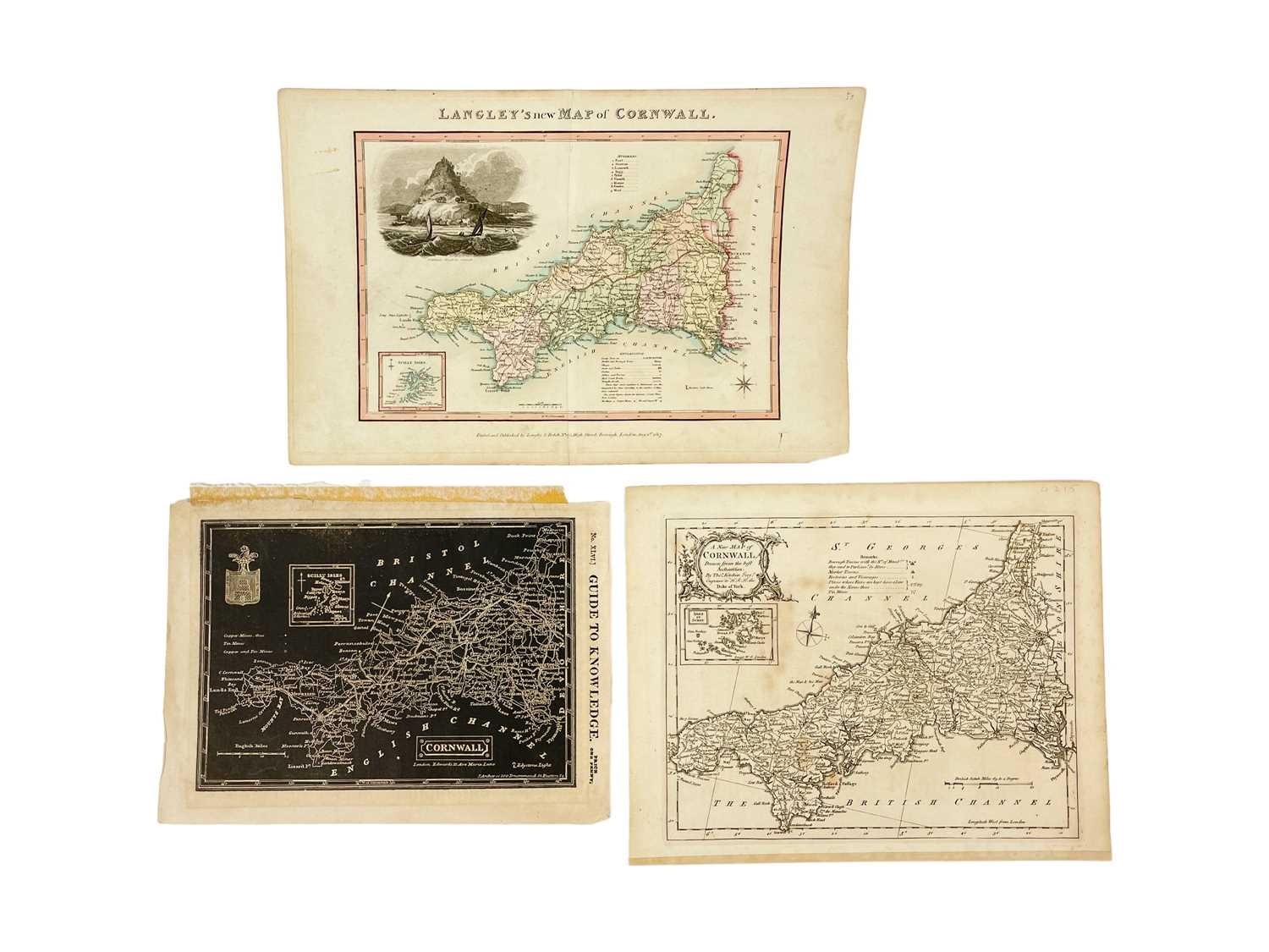
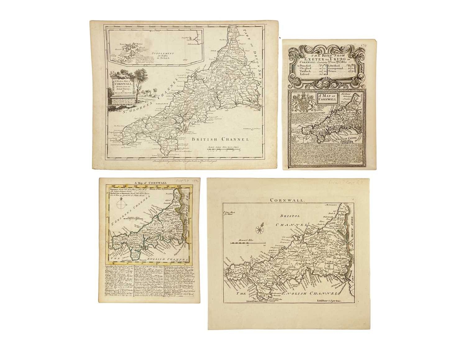
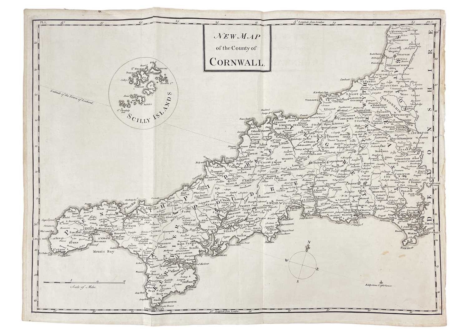
(Cornwall) A fine collection of (mostly) scarce maps Richard Blome. 'A Table of the Hundreds in the County of Cornwall,' uncoloured engraved map, centre fold, engraved view of Pentillie Castle (page 54 in Quixley & Quixley for an interesting history of James Tillie), small nibbles to edges of leaf measuring 23xm x 33cm, [published in Cosmography and Geography, Samuel Roycroft, 1693]; Louise Stanislas D'Arcy De La Rochette. 'A Modern Map of Cornwall, Drawn from an Actual Survey,' uncoloured engraved map, centre fold, 23cm x 28.5cm, some light toning but generally vg, Robert Sayer and Carington Bowles, London, 1765; Astride-Michel Perrot and Migneret. 'Cornwall,' steel engraved map, T.4 to top right corner, leaf size, 15.5cm x 9.5cm, [c.1824]; Andrew Dury & Joseph Ellis. 'Cornwall,' later coloured, 12cm x 15.5cm, [c.1764]; Thomas Kitchin & Thomas Jefferys. 'A Map of Cornwall,' coloured borders, descriptive text below engraved map, 19cm x 15.5cm, centre fold, M. Payne and M. Cooper, London, 1749; Thomas Read & John Rocque. 'Cornwall,' uncoloured, leaf measures 23cm x 24.5cm, plate number 6, T. Read, London, 1746; Van Langeren (Jacob & Simmons Matthew). 'Cornewall,' uncoloured engraved map and mileage triangle, rare, 10.5cm x 10.5cm, [c.1662]; Pieter Van Den Keere. 'Cornuwallia,' copper engraved map, latin text to verso, one tiny spot (or burn), leaf measures 9.5cm x 14.5cm, plate number 101, Amsterdamn, 1617-1676; Thomas Badeslade & Thomas William. 'A Map of Cornwall,' copper engraved map with text, centre fold, some toning, 16.5cm x 18cm, W. H. Toms, London, 1721; Emanuel Bowen. 'The Road from Exeter to Truro,' uncoloured, page number 179, strip map from Exeter to Tavistock to verso, 19.5cm x 14cm, T. Bowles, London, 1720-1765; John Gibson. 'An Accurate Map of Cornwall from an Actual Survey,' uncloured copper engraved map, some text offsetting, fold, 21cm x 26cm, J. Payne, London, 1762; William Pinnock & Joshua Archer. 'Cornwall,' stark white on black printing, leaf measures 19.5cm x 27.5cm with remnants of tape, William Edwards, 1833; Edward Langley and William Belch. 'Langley's new Map of Cornwall,' coloured steel engraved map, vignette of St Michaels Mount, leaf measures 22cm x 35cm, centre fold, Langley & Belch, London, 1818; William Borlase. 'New Map of the County of Cornwall,' uncoloured, lacks imprint, folds, [c.1754]; With three various issues by Thomas Kitchin. (17) A diverse selection. Reference Antique Maps of Cornwall and the Isles of Scilly by R.C.E. Quixley and J.M.E. Quixley (2018)
Fees apply to the hammer price:
Free Registration
28.8% inc VAT*
Flat Fee Registration
25.20% inc VAT*