


£110
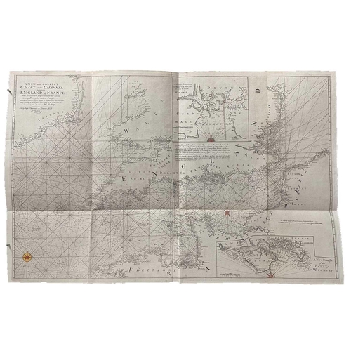
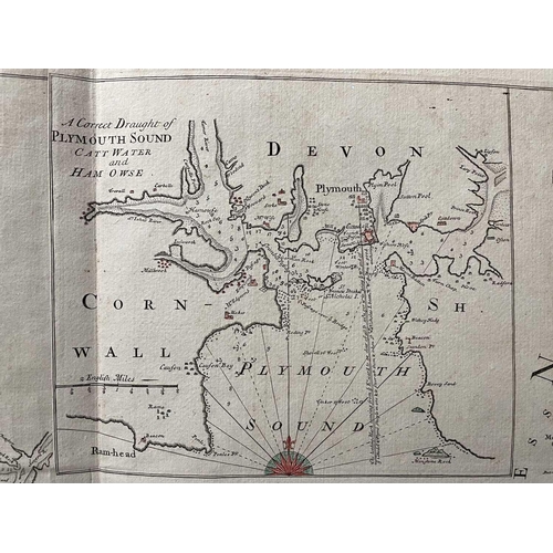
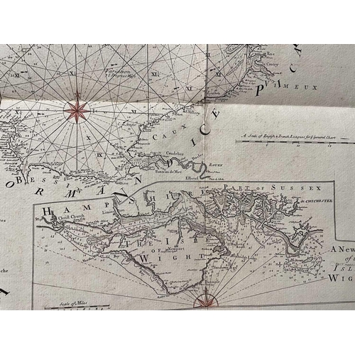
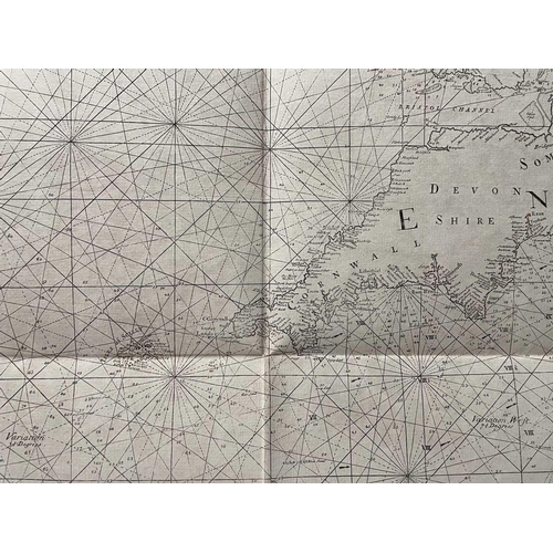
Dr EDMOND HALLEY. 'A New and Correct Chart of the Channel between England & France: with considerable Improvement not extant in any Draughts hither to Published; shewing the Sands, Shoals, depths of Water and Anchorage, with ye flowing of the Tides, and setting of the Currents; as observed by the Learned Dr Halley,' a late 18th century or early 19th century engraved map, insert port charts of Plymouth and the Isle of Wight, amatuer colouring of compass roses to an otherwise very good to fine folding map, Page & Mount, Tower Hill, London. 67cm x 104cm
Fees apply to the hammer price:
Free Registration
25.2% inc VAT*
Flat Fee Registration
21.60% inc VAT*